FFI: a software tool for ecological monitoring*

Duncan C. LutesA,F, Nathan C. BensonB, MaryBeth KeiferC, John F. CarattiD and S. Austin StreetmanE

ARocky Mountain Research Station, Fire Sciences Laboratory, 5775 US Highway 10 West,
Missoula, MT 59808, USA.
BNational Park Service, National Interagency Fire Center, 3833 South Development Avenue,
Boise, ID 83705, USA.
CNational Park Service, Pacific West Regional Office, 1111 Jackson Street, Oakland,
CA 94607, USA.
DSystems for Environmental Management, PO Box 8868, Missoula, MT 59807, USA. ESpatial Dynamics, 910 N Main St, Suite 342, Boise, ID 83702, USA.
FCorresponding author. Email: dlutes@fs.fed.us


Abstract. A new monitoring tool called FFI (FEAT/FIREMON Integrated) has been developed to assist managers with collection, storage and analysis of ecological information. The tool was developed through the complementary integration of two fire effects monitoring systems commonly used in the United States: FIREMON and the Fire Ecology Assessment Tool. FFI provides software components for: data entry, data storage, Geographic Information System, summary reports, analysis tools and Personal Digital Assistant use. In addition to a large set of standard FFI protocols, the Protocol Manager lets users define their own sampling protocol when custom data entry forms are needed. The standard FFI protocols and Protocol Manager allow FFI to be used for monitoring in a broad range of ecosystems. FFI is designed to help managers fulfil monitoring mandates set forth in land management policy. It supports scalable (project- to landscape-scale) monitoring at the field and research level, and encourages cooperative, interagency data management and information sharing. Though developed for application in the USA, FFI can potentially be used to meet monitoring needs internationally.

Additional keywords: data management, fire effects, monitoring system, Protocol Manager.

CLICK HERE TO DOWNLOAD AS PDF


Introduction

FFI (FEAT/FIREMON Integrated) is a software tool developed in the United States and designed to assist managers with collection, storage and analysis of ecological monitoring information. This tool was developed through a complementary integration of two fire effects monitoring systems commonly used in the US: FIREMON (Lutes et al. 2006) and the Fire Ecology Assessment Tool (FEAT ) (Sexton 2003). The National Interagency Fuels Coordination Group sponsored development of FFI and the National Park Service (NPS) was the managing partner.

FEAT was developed from the NPS Fire Monitoring Handbook (FMH) (USDI 1992, 2003) and associated software (Sydoriak 2001). This handbook was initially developed by the Pacific West Region of the NPS to guide fire-related ecological monitoring in California, Oregon and Washington. The handbook provides detailed descriptions for establishing a sampling strategy based on levels of monitoring activity relative to fire and resource management objectives. FMH had a DOS-based software package for entering data into a Microsoft FoxPro database. Beginning in 1995, the NPS conducted a series of regional work shops to examine user needs for fire and ecological monitoring throughout the entire NPS; then in 1996, FMH was adopted by all NPS regions across the US. The handbook was updated first in 2001 and again in 2003 to reflect the national scope of the system. The FMH software was replaced in 2005 with a Windows-based system that became known as the Fire Ecology Assessment Tool. FEAT uses a Microsoft SQL Server database that is much more flexible than the original DOS-based program, allowing data from a greater variety of field-sampling procedures to be stored in the database, greater ability to query data and export data, provided Geographic Information System (GIS) tools, and supported Personal DigitalAssistant (PDA) use.

The FIREMON fire effects monitoring system was developed by the USDA Forest Service (USFS) Missoula Fire Sciences Laboratory through a grant from the Joint Fire Science Program in 2000. Many of the protocols in FIREMON were taken from the ECODATA ecological monitoring program used in Region One of the USFS (Keane et al. 1990). ECODATA used an IINFOS data management system and FORTRAN-77-based data analysis package called ECOPAK. FIREMON uses Java-based data entry software and a Microsoft Access database. The FIREMON software package includes report and analysis software, and a


∗The content of the present paper was written and prepared by US Government employees on official time, and therefore it is in the public domain and not subject to copyright in the US. The use of trade or firm names in the present paper is for reader information and does not imply endorsement by the US Department of Agriculture of any product or service.


handbook with sampling strategy and detailed field-sampling procedures.

FEAT and FIREMON both facilitate fire-ecology monitoring and have similar procedural characteristics and database architecture. Their integration results in an enhanced ecological monitoring tool. FFI includes an extensive list of sampling protocols and users are able to define their own protocols in Protocol Manager, if necessary. Although the core fire ecology components are still part of FFI, the new flexibility means FFI can be used more broadly for monitoring a wide variety of ecosystem attributes. FFI is now better suited to assist managers in meeting the monitoring mandates set forth in land management policy (for example, the US National Environmental Policy Act). It eases data collection; supports cooperative, interagency data management and information sharing, and supports scalable (site-specific to landscape-level) monitoring for both field application and research needs.

FFI provides data entry and storage for a set of ‘standard’ protocols delivered with the software, summary reports, analysis tools, GIS and PDA support. Protocol Manager – described in more detail below – is an FFI component that allows design of new sampling protocols, thus making the FFI database capable of storing data in not just the standard protocols delivered with the FFI software but also any protocol designed by the user.

FFI is designed for Microsoft Windows XP operating systems. Data are stored in a Microsoft SQL Express 2005 database and accessed with SQL and Microsoft Visual Basic.NET programs. ESRI Arc products are used for GIS functionality. The system is designed for the varying information technology requirements of the USFS, NPS, Bureau of Land Management (BLM), Bureau of Indian Affairs (BIA) and the US Fish and Wildlife Service (FWS).

The relationship of the three FFI software components is shown in Fig. 1. The FFI Database Administration component interfaces with SQL Server Express 2005 and is used for general database management functions like creating and deleting databases. This component is also used to add users and user roles to each database. The SQL databases in FFI have either a ‘Protocol Manager’ or ‘Data Capture’ schema. Protocol Manager databases contain the design criteria for each protocol and provide the list of data fields viewed in the FFI Data Entry software. Data capture databases store field data the user enters in the FFI Data Entry software.

Development and testing

Like FEAT and FIREMON before it, FFI incorporates the evolutionary improvements of the systems it was borne from. In addition, FFI has benefited from its own testing and improvement process. Many hours were spent considering use cases and system architecture, testing the user interface and checking coded procedures. The present work was done in cooperation with employees from numerous US land management agencies. An FFI Testing  Workshop was held inAugust 2007 to intensively test the FFI software, again with agency cooperation. After the August workshop, nine additional versions of FFI were built and tested before it was finally released in November 2007. We continue to compile a list of suggested improvements to the system, such as new protocols, and additional summary reports and analysis that will be incorporated in future versions. Where applicable, FFI has either been approved or is in the process of being approved by the US land management agencies.

Fig. 1. Relationship of the three FFI software components.

Species lists

FFI incorporates the US Department of Agriculture Natural Resource Conservation Service PLANTS database (USDA and Natural Resources Conservation Service 2008). Users query the PLANTS database to populate a ‘local’ species list using the FFI species management utility. Species in the local list appear in species dropdown menus on the data entry screens. Species or items not available in the PLANTS database can be included in the FFI local list by adding a ‘user species’. For example, if a user is interested in sampling pine-cone density, then ‘pinecones’ can be added as a user species and it will be included on the species list dropdown menus on the data entry screens. The FFI local species list will also accommodate an unlimited number of ‘unknown’ species. This option is useful when field crews do not have the expertise to identify all the species encountered. In that case, they can record the species as an unknown on the data collection form (for example, UNK01) and collect a sample. When the sample is identified by a botanist, the FFI species management utility can be used to replace the unknown species with its appropriate species name in the FFI local species list and FFI database. The FFI species management utility can also be used to replace a species name if the species was misidentified in the field. The FFI local species list can be exported from one FFI database and imported to another.

The master species list included with FFI is the component most likely to limit the use of FFI; however, with a minimum amount of development, any master species list can be incorporated in FFI, allowing it to be used outside the US. Interested parties can build their own ‘user species’ list and test FFI before making the commitment of incorporating a new master species list. Further, when used in conjunction with the Protocol Manager, a new master species list and sampling protocols will allow FFI to be used for sampling other life forms such as terrestrial wildlife.

Data entry and storage

FFI provides programmed data entry screens for entering data into the Microsoft SQL database. Entry screens are provided for


Table 1. Protocols delivered with FFI

Protocols not available in FIREMON or FEAT are listed as ‘New’ and, when applicable, the source of the protocol is provided plot location, surface fuels, tree data, point intercept, density, line intercept, rare species, cover/frequency, species composition, fire behavior, disturbance history, Fuel Characterization Classification System (FCCS), post-burn severity and compos- ite burn index (CBI). FFI also has a ‘Biomass – Fuels’ protocol for storing ocular or photographic estimates of biomass, for example those found in the USFS Pacific Wildland Fire Sciences Laboratory Natural Fuels photo series. Data entry screens have built-in flexibility to accommodate data from a wide variety of plot-based sampling schemes. The data entry fields represent a combination of those in the FEAT and FIREMON, so data can be collected using the methods described in the FMH (USDI 2003) or the FIREMON manual (Lutes et al. 2006) field manuals and stored in an FFI database. In many cases, the FFI database will also accommodate data collected with field-sampling protocols from other publications.


Protocol Source
Biomass – Fuels New
Biomass – Plants FEAT
Composite burn index FEAT and FIREMON
Cover – Line intercept FEAT and FIREMON
Cover – Species
composition (ocular macroplot)
FEAT and FIREMON
Cover – Individual points FEAT
Cover – Points by
transect
FIREMON
Cover/Frequency
(Daubenmire)
FEAT and FIREMON
Density – Belts FEAT and FIREMON
Density – Quadrats FEAT and FIREMON
Fuel Characteristic
Classification System
NewA
Fire behavior FIREMON
Plot description (biotic,
abiotic variables, fire behavior, photo links)
FIREMON
Post-burn severity FEAT
Rare plant species FIREMON
Surface fuels (downed
woody material, duff, litter)
FEAT and FIREMON
Surface fuels – Alaska
duff and litter
NewB
Surface fuels – Piles NewC
Surface fuels –
Vegetation
FIREMON
Tree data FEAT and FIREMON

AOttmar et al. 2007.
BAlaska Interagency Fire Effects Task Group 2007.
CHardy 1996.


Sampling protocols

The ‘standard set’ of sampling protocols delivered with the FFI software is listed in Table 1 as well as the source of the protocol, where applicable. The protocols were developed from the existing, recognized methods previously available in FEAT and FIREMON and supplemented with new protocols suggested during FFI development. Protocols that require unit data are available in metric and imperial unit versions. Although FFI was developed from fire effects systems, the wide array of protocols makes the system applicable for monitoring rangeland, forest and other ecosystems regardless of the presence or absence of fire as a disturbance.

Protocol Manager

Protocol Manager is a unique extension to FFI that lets users design new protocols that can then be imported for use in FFI. A protocol is defined as a set of methods implemented separately to perform a certain task. The user defines methods and combines them in Protocol Manager to build a protocol that will facilitate a comprehensive assessment of ecosystem attributes important to the user. User-defined methods can be highly varied, ranging from new methods to monitor vegetation to methods to monitor mammals, birds, amphibians, reptiles, insects or aquatic species. Protocol Manager also records metadata for each protocol (e.g. plot size, plot shape, quadrat size). The data recorded with user-defined protocols are stored in the same database as data collected with the standard FFI protocols.

Queries, reports and analysis

FFI includes the query features found in FEAT with added functionality to allow data to be queried from userdefined protocols designed in the Protocol Manager. The Query screen lets the user retrieve method data in a flexible, ad hoc manner in which values are filtered and parameters are defined through the user interface. The data summary reports and analysis tools are an expanded set of those provided in FIREMON. The FFI summary reports provide plot-by-plot summaries or grouped summaries of measured attributes such as trees per acre, downed woody material biomass, frequency, cover and density. The FFI analysis tools program can perform grouped or ungrouped summary calculations of a measured attribute, or statistical comparisons of grouped or ungrouped plot data taken at different sampling periods. For statistical comparisons, the analysis tools assume data were collected in a randomized block design with each time-point structured as a block. Parametric analyses are made using analysis of variance. If a significant difference in means is noted, Dunnett’s multiple comparison procedure is used to compare treatment groups with a designated control group to identify which means are different. Friedman’s test is provided for non-parametric analyses. A minimum of four plots per group is required for statistical analysis. Reports and graphs can be saved to a file, printed, or cut-and-pasted into other documents. Statistical testing procedures were developed with guidance of station statisticians at the USFS Rocky Mountain Research Station. As an additional feature, tree and fuels data can be exported to build files necessary to run the Forest Vegetation Simulator (FVS) (Dixon 2002).

GIS

The GIS module is an optional component users can add to FFI. It is similar to the GIS module in FEAT and is accessible inArcMap as a tool bar. Users who desire GIS capability need to have an understanding of GIS, and must have ArcGIS 9.2 and Spatial Analyst installed on their computers. The GIS module does not deliver any data layers or attempt to manage GIS data. Users may need the help of a GIS specialist to identify the appropriate GIS data for their needs if they utilize the FFI GIS module.

The GIS module provides support for developing geographic project areas. A custom tool allows users to overlay different types of GIS layers that identify the geographical area of their sample population. The GIS module also allows users to randomly or selectively choose sample points within polygons (e.g. burn severity classes or vegetation classes) that can then be passed to the FFI database. The module supports basic display of FFI macro plot sites and the interactive spatial queries of the collected data using the ArcMap tools. Tools that identify severity thresholds in Differenced Normalized Burn Ratio layers for CBI (Key and Benson 2006) sampling are also included.

Electronic field data collection

Electronic field data collection is facilitated using a PDA or data recorder equipped with the Microsoft Windows Mobile 5 operating system and requires Microsoft ActiveSync to manage the connection between the PDA and the FFI host computer. The PDA application first moves empty electronic field data collection forms to the PDA for user-specified macro plots, protocols, and sampling events. When data collection is complete, the application then moves data from the PDA back into the FFI database, appending the data already stored. Data entered on the PDA are editable on the PDA until they are uploaded to the host FFI database; then they may be edited in the host database if the user has the appropriate permission level.

Computer configuration

Computers used for implementation of FFI fall into three categories: isolated computers, desktop as server and a limited access server (Fig. 2).The configuration chosen by users depends on individual needs and available computer resources. When GIS functionality is desired, ArcGIS 9.2 and Spatial Analyst must be installed and run from computers that have the FFI software installed on them.


Isolated computers as servers
Limited access server
Desktop as server

Fig. 2. The three main computer configurations used with FFI.

Isolated computer as server

The stand-alone computer has no other computers attached to it that share its internal databases. This configuration has both the FFI software and SQL Server installed.

Desktop as server

One computer with FFI and SQL Server installed is connected via a network to other computers that have FFI and SQL Server components installed on them. Data entry can be accomplished on any of the computers. Database storage and management occurs on the desktop server.

Limited access server

A database server is a dedicated computer running a database engine that can be either accessed directly from a server or client computer with password protection or via intranet access. This configuration has SQL Server only installed on the database server and FFI and SQL Server components installed on the connected computers.

System security

FFI supports four levels of internal data access or user permission levels. The goal of the permission levels is to balance system accessibility with data security. For example, some users will only need to query data for summarization and analysis whereas other users will need access to edit data for quality analysis and quality control (QA/QC). Each user role has different permissions for the FFI program and its databases:

  • The FFI Administrator can modify the database schema, create new database instances, import external data, and manage database users. Record locking will require FFI Administrator privileges. Administrators can also do any activities assigned to Managers, Users and Readers.
  • FFI Managers can create protocols and methods. Managers can also do any activities assigned to Users and Readers.
  • FFI Users can read and write FFI data, queries, and reports, and export FFI data. FFI Users cannot change the database schema.
  • FFI Readers will have read-only access to FFI. FFI Readers can export FFI summary reports, analysis reports and query results.

Hardware requirements

The FFI software requires MicrosoftWindows XP Service Pack 2 or XP 2003 operating systems. Data must be stored in Microsoft SQL Server Express 2005 or SQL Server 2005 full edition database. The FFI software and SQL Server Express require 500 MB combined free disk space for installation. The FFI SQL databases range from 100 MB to 4 GB in size (4 GB is the maximum size for SQL Server Express 2005 databases. Larger databases can be stored in SQL Server full edition). Recommended minimum processor speed and random access memory are 1 GHz and 512 MB, respectively. Increasing memory to 1 MB enhances system performance.

Technology transfer

FFI is supported by annual training workshops and on-line presentations. User assistance is provided through the FFI Website, help-desk and Web forum. Training schedules, software installation packages, documentation and technical support contacts are provided on the FFI Website (http://frames.nbii.gov/ffi, accessed 28 April 2009).


Acknowledgements

Funding for FFI was provided by the National Interagency Fuels Coordination Group. Additional support was provided by the NPS, USFS, Systems for Environmental Management and Spatial Dynamics. We specifically thank
Melissa Forder and Dan Swanson (NPS), Clint Isbell (USFS), Charley Martin, Chamise Kramer and Jena Dejuilio (BLM), Bil Graul (San CarlosApache Tribe), Ben Butler (Student Conservation Association), Kristin Swoboda
(Bureau of Reclamation) and Jacque Schei (US Geological Survey) for β testing FFI in August 2007. Jennifer Allen (NPS), Karen Murphy (US FWS), and Randi Jandt (BLM) helped us develop the Alaska Surface Fuels protocol; Roger Ottmar (USFS, Pacific Northwest Research Station) and Susan Pritchard (University of Washington) assisted with development of the FCCS protocol; and Colin Hardy (USFS, Rocky Mountain Research Station) helped us incorporate the Surface Fuels – Piles protocol. Additionally, numerous helpful comments were provided by employees at each of the agencies and organizations already recognized and also the BIA, US Department of the Army and The Nature Conservancy. Chad Keyser (USDA Forest Service, Forest Management Service Center) helped us update the FVS file-building utility in FFI. We thank Rudy King and David Turner of the USFS, Rocky Mountain Research Station, for their assistance in developing the statistical analysis tools available in FFI. Finally, we acknowledge the helpful comments of the anonymous reviewers.


References

Alaska Interagency Fire Effects Task Group (2007) Fire effects monitoring protocol (version 1.0). (Eds J Allen, K Murphy, R Jandt) Available at http://depts.washington.edu/nwfire/publication/AK_Fire_Effects_ Monitoring_Protocol_2007.pdf [Verified 28 April 2009]

Dixon GE (2002) Essential FVS: a user’s guide to the Forest Vegetation Simulator. USDA Forest Service, Forest Management Service Center, Internal Report. (Fort Collins, CO) Available at http://www.fs.fed.us/fmsc/fvs/documents/gtrs_essentialfvs.php [Verified 28 April 2009]

Hardy CC (1996) Guidelines for estimating volume, biomass, and smoke production for piled slash. USDA Forest Service, Pacific Northwest Research Station, General Technical Report PNW-GTR-364. (Seattle, WA)

Keane RE, HannWJ, Jenson ME (1990) ECODATA and ECOPAC: analytical tools for integrated resource management. The Compiler 8, 24-37.

Key CH, Benson NC (2006) Landscape assessment. In ‘FIREMON : Fire Effects Monitoring and Inventory System’. (Eds DC Lutes, RE Keane, JF Caratti, CH Key, NC Benson, S Sutherland, LJ Gangi) USDA Forest Service, Rocky Mountain Research Station, General Technical Report RMRS-GTR-164-CD. (Fort Collins, CO)

Lutes DC, Keane RE, Caratti JF, Key CH, Benson NC, Sutherland S, Gangi LJ (2006) FIREMON : Fire Effects Monitoring and Inventory System. USDA Forest Service, Rocky Mountain Research Station, General Technical Report RMRS-GTR-164-CD. (Fort Collins, CO)

Ottmar RD, Sandberg DV, Riccardi CL, Prichard SJ (2007) An overview of the Fuel Characteristic Classification System – quantifying, classifying, and creating fuelbeds for resource planning. Canadian Journal of Forest Research 37(12), 2383-2393. doi:10.1139/X07-077

Sexton TO (2003) Fire Ecology Assessment Tool – monitoring wildland fire and prescribed fire for adaptive management. In ‘2nd International Wildland Fire Ecology and Fire Management Congress’, 19 November
2003, Orlando, FL. (American Meteorological Society: Boston, MA) Sydoriak WM (2001) FMH.EXE. Version 3.1x. (National Park Service: Boise, ID)

USDA and Natural Resources Conservation Service (2008) ‘The PLANTS Database.’ (National Plant Data Center: Baton Rouge, LA) Available at http://plants.usda.gov [Verified 28 April 2009]

USDI (1992) ‘Western Region Fire Monitoring Handbook.’Western Region Prescribed and Natural Fire Monitoring Task Force. (National Park Service: San Francisco, CA)

USDI (2003) ‘Fire Monitoring Handbook.’ Fire Management Program Center, National Interagency Fire Center. (National Park Service: Boise, ID) Available at http://www.nps.gov/fire/download/fir_eco_FEMHandbook2003.pdf [Verified 28 April 2009]


Manuscript received 29 May 2007, accepted 16 May 2008

 

Managing forests with prescribed fire: Implications for a cavity-dwelling bat species

Justin G. Boylesa, Doug P. Aubreyb,*

a Department of Ecology and Organismal Biology, Indiana State University, Terre Haute, 47809, USA
b USDA Forest Service, Savannah River, P.O. Box 700, New Ellenton, SC 29809, USA
Received 1 June 2005; received in revised form 27 September 2005; accepted 30 September 2005


Abstract

Prescribed burning is used as a restoration and management technique in many deciduous forests of eastern North America. The effects of fire have been studied on habitat selection of many vertebrate species, but no studies have reported the effect of fire on bat roosting habitat. Fire initially leads to an influx of dead and dying trees, an increase of light availability, and a decrease of canopy and sub-canopy tree density. These characteristics are beneficial to many forest-dwelling vertebrates including cavity-roosting bats. We evaluated evening bat (Nycticeius humeralis) roost-site selection at the stand-scale in order to determine roosting preferences as they relate to prescribed burning. Standard radiotelemetry techniques were used to locate evening bat roost trees. Canopy light penetration and overstory tree density were measured in both burned and unburned forests. Sixty-three trees used as roosts by both male and female evening bats were located during both the summer and winter and all 63 roosts were located in the burned portion of the study area. Canopy light penetration was higher and canopy tree density was lower in the burned forest than unburned forest. An increase in light availability may release bats from one of the constraints suggested for many forest-dwelling bat species in roost tree selection—sun-exposure. This should increase the abundance of trees with characteristics suitable for roosting and may allow bats to roost throughout the interior of the forest as opposed to only on forest edges, thereby allowing bats to roost closer to foraging grounds and possibly lessening predation rates. Lower tree density may allow for ease of flight within the forest as well as more efficient locating of roost trees. In addition, there were a significantly higher proportion of dead trees, which evening bats commonly use as roost trees, in burned forests compared to unburned forests. Prescribed burning appears to initially lead to creation or restoration of favorable cavity-dwelling bat habitat and its continual implementation perpetuates an open sub-canopy. Therefore, we suggest that prescribed burning may be a suitable tool for management of roosting habitat for cavity-roosting bats.

# 2005 Elsevier B.V. All rights reserved.

Keywords: Fire ecology; Forest restoration; Nycticeius humeralis; Oak-hickory forest; Prescribed burning; Roost selection

CLICK HERE TO DOWNLOAD AS PDF


1. Introduction

Fire is critical in regulating and maintaining many forest ecosystems (Huddle and Pallardy, 1996; van Lear, 2002). In particular, much of the western portion of North America’s eastern deciduous forest is thought to have been shaped and maintained through fires set by Native Americans prior to European settlement (Cottam, 1949; Ladd, 1991; Pyne, 1982). Prescribed burning has been shown to alter many characteristics of forest habitat potentially affecting forest-dwelling bats including tree mortality, which increases available trees commonly used by wildlife (Huddle and Pallardy, 1996; Arthur et al., 1998; Hartman and Heumann, 2003; Aubrey, 2004); pathogen susceptibility, which expedites cavity formation (Burns, 1955; Paulsell, 1957; Smith and Sutherland, 2001); and canopy light penetration (Anderson and Brown, 1986; McCarty, 1998; Aubrey, 2004), which is known to affect roost suitability (Kurta et al., 1993; Brigham et al., 1997).


* Corresponding author. Tel.: +1 803 725 1758; fax: +1 803 725 0311.
E-mail address: daubrey@fs.fed.us (D.P. Aubrey).

0378-1127/$ – see front matter # 2005 Elsevier B.V. All rights reserved.
doi:10.1016/j.foreco.2005.09.024


Many forests are managed for timber harvest by the use of mechanical thinning or clear-cutting. Prescribed fire differs from these management techniques because fire is generally used to maintain or restore natural forest ecosystems and reduce understory competition, while other silvicultural methods are predominately used to maximize harvest yield and quality. When first implemented, prescribed burning decreases overstory tree density and basal area (Anderson and Brown, 1986; Peterson and Reich, 2001). Following this initial fire with frequent  burns generally reduces fuel accumulation and subsequent burns are therefore relatively cool and somewhat nonuniform (Ladd, 1991). However many fire-sensitive seedlings and saplings are generally eliminated or prevented from regenerating (Lorimer, 1985; Ladd, 1991; Moser et al., 1996; Brose and van Lear, 1997; Barnes and van Lear, 1998). Fire-tolerant trees remain as overstory dominants and canopy recruitment coincides with periods of decreased burn frequency or intensity (Crow et al.,1994). For example, oaks possess thick bark which insulates them from heat associated with burning and are capable of rapid compartmentalization when damaged by fire which inhibits fungal infection and makes mature individuals relatively tolerant of fire (Lorimer, 1985; Abrams, 1985; Crow, 1988; Stearns, 1991; Smith and Sutherland, 1999; Peterson and Reich, 2001). Much of the western portion of the eastern deciduous forest is believed to have resembled the structure and composition of a woodland (i.e. moderate to low canopy coverage) more than a forest (i.e. high canopy coverage) prior to European settlement, which is largely attributed to fire (Cottam, 1949; Curtis, 1959; Nuzzo, 1986; Ladd, 1991). Therefore, managing forests with prescribed fire reintroduces a historic disturbance process that other silvicultural techniques lack, and may provide a more heterogeneous habitat for wildlife that is similar to forested areas prior to wide-spread fire suppression by European settlers. Furthermore, prescribed burning has become increasingly common over the past few decades, as land managers have seen the effects of fire suppression. Specifically, fire has been most commonly reintroduced to systems where conservation of biodiversity and restoration of historic ecosystem processes are paramount.

Numerous studies have focused on vertebrates in forests maintained by prescribed burning (e.g. reptiles, McLeod and Gates, 1998; small mammals, Simon et al., 2002; amphibians, Schurbon and Fauth, 2003; birds, Blake, 2005). However, to our knowledge, there are no studies reporting habitat selection of tree-dwelling bats in burned forests, although the need for such studies has been suggested (Menzel et al., 2001b; Carter et al., 2002). Furthermore, the effects of forest management on roosting habitat of bats are not clear and it has been suggested that wildfires and prescribed burning may have detrimental (Chambers et al., 2002) or beneficial (Carter et al., 2002) impacts on bats. For some bat species, such as the eastern red bat (Lasiurus borealis), fire may pose a direct threat to survival as early spring burns remove litter where occasional winter roosting occurs and can potentially scorch hibernating individuals (Moorman et al., 1999; Rodrigue et al., 2001). Bats roosting in snags (standing dead trees) are also susceptible to direct disturbance from fire if roost trees ignite (Rodrigue et al., 2001), but this is probably not a major cause of mortality unless the roost burns quickly and the bat is in deep torpor (Carter et al., 2002). Availability of suitable roosts likely influences habitat selection (Kunz, 1982) and roosting sites are thought to be of critical importance to conservation of many bat species (Fenton, 1997). Fire generally removes understory saplings and may lead to the creation of suitable roost trees for cavity-roosting bats. Fire may also remove standing snags if fuel loading is high. However, fuel should not accumulate directly under a snag when burning is frequent so snags should persist under these circumstances. As fire increases the heterogeneity of forest structure and composition (Fule et al., 2004), there should be an increase in the diversity of available roosting habitat.

Previous studies have focused on activity (Humes et al., 1999; Patriquin and Barclay, 2003; Tibbels and Kurta, 2003; Mazurek and Zielinski, 2004), demographic parameters (Miller, 2003), and roosting preference (Campbell et al., 1996; Menzel et al., 2002; Elmore et al., 2004) of bats in heavily managed forests, but have not examined fire-based management. With the exception of a few anecdotal reports of L. borealis being driven from their leaf litter  ibernacula during winter burns (Moorman et al., 1999; Rodrigue et al., 2001), there is little empirical data about how fire affects forest dwelling bats.

The objective of this study was to determine evening bat (Nycticeius humeralis) roost-site selection at the stand-scale in a forest heavily managed by fire and to understand those characteristics of the forest that may influence roost tree selection. The evening bat is a locally abundant cavity-dwelling bat species found throughout much of the southeastern United States, but it may be declining in parts of its range (Whitaker et al., 2002; Whitaker and Gummer, 2003). Evening bats are known to roost in large numbers in man-made structures (Watkins, 1969; Watkins and Shump, 1981; Bain and Humphrey, 1986; Wilkinson, 1992) and tree cavities (Wilk-inson, 1992; Bowles et al., 1996; Menzel et al., 1999, 2001a; Boyles et al., 2003; Boyles and Robbins, in press). Evening bats roost mainly in cavities in trees of various stages of decay (Bowles et al., 1996; Boyles and Robbins, in press), but relatively little is known about the formation or microclimate of the roosts. During the summer, evening bats roost mainly in large dead trees, but during the winter, live trees are commonly used (Boyles and Robbins, in press). They have a short wingspan and high wing loading so it has been predicted that they are not highly maneuverable relative to other bat species (Norberg and Rayner, 1987). Due to relatively inefficient flight, this species may avoid long foraging trips (Norberg and Rayner, 1987) and it has been suggested that evening bats forage close to their roosting areas  Duchamp et al., 2004). Evening bats feed heavily on coleopterans, homopterans, and hemipterans (Whitaker, 2004). As with other tree roosting bat species, they spend over half of its time each day in roosts (Brigham et al., 1997), so conserving roosts is important in managing this species. Evening bats are commonly referred to as migratory in middle latitudes (Jones et al., 1967; Humphrey and Cope, 1968; Watkins, 1969; Wilkinson, 1992; Sparks et al., 1999; Geluso et al., 2004), but it appears that the population discussed herein is largely non-migratory (Boyles et al., 2003; Boyles and Robbins, in press) so roost trees refer to trees used throughout the year.

It was predicted that evening bats would prefer roosting in burned forests because of an increase in the density of dead and dying trees, an increase in light penetration and an overall decrease in overstory and understory tree  ensity. These characteristics should benefit forest-dwelling bats and promote use of burned forests as roosting habitat. This study compliments previous work (Boyles and Robbins, in press), which reports the characteristics of roost trees and the surrounding habitat used by this population of evening bats during both the summer and winter. The results presented herein focus on roost selection at the forest stand-level.


2. Methods

2.1. Study area

We conducted this research on the Drury Conservation Area (DCA) in Taney County, Missouri (UTM 40.47.000N, 4.93.000E). DCA is a 1200 ha area located in extreme southwestern Missouri in the Ozark Mountains Region and is bordered on two sides by Bull Shoals Lake. It is actively managed by the Missouri Department of Conservation, which has implemented prescribed burning on approximately 55% of the potential area available for roosting habitat in an attempt to restore historic glades and oak-hickory woodlands and reduce red cedar (Juniperus virginiana) concentrations. Burning was initiated in 1999 after nearly 50 years of fire suppression and the area was then burned on a biennial schedule. All burning was conducted in March or April. The initial 1999 burn was probably more intense than subsequent burns because of accumulated fuels; therefore more overstory tree mortality may have occurred during or as a result of the initial burn (Aubrey, 2004).

Approximately 60% of DCA is dominated by oak-hickory forest with the remainder of the area being glades, wildlife food plots, ponds, and riparian areas (Missouri Department of Conservation, 1991). Elevation ranges from 185 to 335 m on DCA. Several gravel roads facilitate access to the interior of much of the forest and one large gravel road serves as the firebreak between burned and unburned portions of the forest. The canopy of the area consists almost entirely of deciduous trees from the white and red oak groups (Quercus spp.), hickories (Carya spp.), elms (Ulmus spp.), and ashes (Fraxinus spp.).

2.2. Location of roosting sites

Bats were captured from March 2003 to March 2004 using mist nets (Avinet, Dryden, NY, USA) of various lengths (6, 9, 12, or 18 m) placed across ponds or forest roads. The majority of netting sites were on the gravel road that acts as a firebreak between the burned and unburned forest, but one pond and two roads in the burned forest and one pond and one creek bed in the unburned forest were also netted. Approximately 55% of the available roosting area for evening bats was located in an area treated with prescribed fire. Thus, if evening bats were roosting at random, we would expect 55% of roost trees to be located in burned forest and 45% of roost trees to be located in unburned forest. Twenty-three evening bats were fitted with radio- transmitters (0.52 g; Model LB-2N, Holohil, Carp, Canada) by clipping fur to the skin in the interscapular region and affixing the transmitter with surgical adhesive (Skin Bond, Smith and Nephew Inc., Largo, FL, USA). The range of weights of bats fitted with transmitters was 7.5-13.5 g; therefore the transmitter represented 3.9-6.9% of the individual’s body mass.

Each bat’s roost tree was located every day following attachment of the transmitter and tracking was discontinued when the transmitter expired, was shed by the bat, or the bat remained outside of the study area for more than 5 days. This study was conducted year-round so roost trees include those used during both summer and winter by males and females in all reproductive classes (pregnant, lactating, post-lactating, and non-reproductive). All animal handling methods follow guidelines of the American Society of Mammalogists (Animal Care and Use Committee, 1998).

2.3. Canopy light penetration sampling

Leaf area index (LAI) was used as a measure of canopy light penetration to determine if three biennial prescribed burns had resulted in a more open canopy. LAI is an estimate of the ratio of overstory leaf area relative to ground area. A LAI of 0 indicates complete canopy light penetration whereas a LAI of 12 indicates no canopy light penetration (Hyer and Goetz, 2004). Here we define canopy light penetration (CLP) as: 12 LAI.

Two blocks each containing three transects in burned and unburned forests were monitored throughout the 2003 growing season. Unburned and burned forests were adjacent to one another with a gravel road acting as a fire buffer between them. LAI was obtained indirectly at each transect using an AccuPAR PAR-80 light interception device (Decagon Devices Inc., Pullman, WA, USA). Individual light measurements were collected 1.2 m above ground-level at five randomly spaced points along each transect. These five measurements were then averaged to calculate one LAI value, and therefore, one CLP value for each transect per sample period. Measurements were collected monthly throughout the 2003 growing season (April through September). The majority of canopy trees were deciduous species; thus, CLP was high in both burned and unburned forests during winter and was not measured from October through March.

2.4. Tree density

Canopy tree density was estimated in 0.05 ha circular plots centered on 25 randomly selected trees in each of the burn treatments. A random number generator was used to select UTM coordinates for the trees. Coordinates were located using a GPS unit (eTrex, Garmin International Inc., Olathe, Kansas) and selected the tree nearest that point to serve as the center of the plot. All trees in the plot greater than 10 cm diameter at breast height (dbh) were considered overstory trees and were counted and classified as either live or dead.

2.5. Statistical analysis

A binomial probability distribution was used to determine if bats roosted at random or at a proportion different from what would be expected given the amount of burned and unburned forest available. The effect of prescribed fire on CLP was assessed using a multi-factorial analysis of variance (ANOVA). The experiment was a nested block design with repeated measures. Month (April-September) and habitat (burned forest and unburned forest) were treated as fixed factors. Block (n = 2) and transect (n = 12) were treated as random factors, with transect nested under treatment. Mean separations were performed using a post hoc Tukey test. Tree density was analyzed using a t-test. In addition to absolute densities, the arcsine of the proportion of dead trees compared to total trees was calculated and analyzed using a t-test (Zar, 1984). All statistical analyses were conducted in Minitab 14. Alpha is 0.05 for all analyses.


3. Results

3.1. Roost tree location

Fig. 1. Seasonal trends (mean S.E.) in canopy light penetration (CLP) calculated as 12 leaf area index in burned and unburned forest on Drury Sixty-three roost trees were used by 23 (11 females and 12 males) evening bats from 9 March 2003 to 31 March 2004. All 63 roost trees were located in the portion of the area that was subjected to prescribed burning, although many of the bats were captured on the road that serves as the break between burned and unburned forest or within 200 m of that road. Bats roosted in the burned forest exclusively and significantly more often than expected if they selected burned or unburned forest randomly (P < 0.001). In addition, nearly all the trees used as roosts were located more than 50 m from any forest edge (62 of 63). The one exception was a large white oak Quercus alba (L.) used by a male evening bat in October that was located at the forest edge less than 50 m from where that individual was captured. This tree was not used the first day after capture; it was used on the second and fourth days, so it appears that this tree was actively selected and was not used in response to stress caused by handling.

3.2. Canopy light penetration

Both the main effects of treatment (P < 0.001) and month (P < 0.001) as well as their interaction (P < 0.001) signifi-cantly affected CLP. Maximum leaf expansion occurred in May for the burned forest and July in the unburned forest. Averaged over the 6-month sample period, canopy light penetration was significantly greater in burned forest as compared to unburned forest (P < 0.001). CLP was high in both the burned and unburned forests in April (Fig. 1). Pairwise comparisons suggest that there was no difference in canopy light penetration between burned and unburned forests in April or May but differences were significant throughout the rest of the growing season (June-September, P < 0.05 in all comparisons). As expected, measurements collected prior to leaf expansion (April) suggest that there was no difference in CLP between the burned and unburned forests; therefore, there was likely no difference in light availability between the treatments during the winter.

Fig. 1.  Seasonal  trends  (mean    S.E.)  in  canopy  light  penetration  (CLP) calculated as 12    leaf area index in burned and unburned forest on Drury Conservation Area, Taney County, Missouri during the 2003 growing season. CLP, as defined herein, is measured on a scale of 0-12, with 12 indicating complete light penetration and 0 indicating no light penetration. All measurements were collected mid-month. Asterisks indicate significant differences (at alpha = 0.05) between burned and unburned forests in each month

3.3. Tree density

Mean overstory tree density per hectare was significantly higher in unburned forest (612.0 25.0) relative to burned Conservation Area, Taney County, Missouri during the 2003 growing season. CLP, as defined herein, is measured on a scale of 0-12, with 12 indicating complete light penetration and 0 indicating no light penetration. All measurements were collected mid-month. Asterisks indicate significant differences (at alpha = 0.05) between burned and unburned forests in each month.


forest (513.6 24.2; t = 2.83, P = 0.007) and live tree density was significantly higher in unburned forest (576.0 24.6) than burned forest (468.0 24.1; t = 3.13, P = 0.003). The density of dead trees was not significantly different between the burned (45.6 7.3) and unburned forests (36.0 4.3; t = 1.14, P = 0.263). However, the proportion of dead trees compared to total trees was significantly higher in burned forest (0.092 0.014) relative to unburned forest (0.060 0.007; t = 2.08, P = 0.045).


4. Discussion

In our study area, evening bats showed a strong preference for forests managed with prescribed fires. Although there are no data on roost tree selection by evening bats before prescribed burning was initiated, it is likely that the forest characteristics were similar between what are now burned and unburned forests (Aubrey, 2004). All roost trees used by both males and females throughout the year were in the burned portion of the study area. For at least a few years after the initial burn, prescribed fire enhances roosting habitat for evening bats in several ways. First, burning increases the abundance of dead trees in some forests (Burns, 1955; Paulsell, 1957; Huddle and Pallardy, 1996; Peterson and Reich, 2001; Fule et al., 2004) and therefore increases the number of tree cavities formed by decay. We did not directly test the effect of fire on overstory tree mortality; however, dead trees were found in higher densities and at significantly higher proportions in the burned forest. Initial burns with high fuel accumulation can result in the formation of dead trees (Paulsell, 1957; Scowcroft, 1966; Anderson and Brown, 1986; White, 1986; Peterson and Reich, 2001) and leads to a forest with a large number of trees in various stages of decay. Ambient temperatures vary widely during the winter in southwestern Missouri so a large number of trees in varying stages of decay may provide sufficient options for evening bats to meet thermoregulatory needs simply by roost-switching. It has also been suggested that fire-scars allow entry for fungal pathogens, which can lead to heartrot and possibly mortality, which should promote cavity formation (Smith and Sutherland, 2001; Parsons et al., 2003). This population of evening bats is known to roost in trees in all decay stages (Boyles and Robbins, in press) and frequent burning should increase options for roost tree selection.

Second, CLP is significantly higher in burned forest than the unburned forest during the growing season. Although evening bats are not known to preferentially roost on forest edges, many tree-dwelling bats are thought to select roost trees that receive high levels of sun-exposure during the summer months (Kurta et al., 1993); therefore, trees selected as roosts are commonly taller than the canopy (Vonhof and Barclay, 1996; Britzke et al., 2003), near forest edges (Grindal, 1999) or areas with an open canopy (Menzel et al., 2001a). High light exposure is known to improve roost suitability (Kurta et al., 1993; Brigham et al., 1997) so high light penetration into the interior forest will allow bats to roost in trees that would not receive adequate sunexposure to facilitate thermoregulation in unburned forests. The ability to roost in interior forest trees that would not receive adequate sun-exposure in unburned forest may yield many benefits for evening bats. For example, the opportunity to use interior forest trees as roosts increases the availability of suitable roost trees in the habitat relative to populations that are forced to roost near forest edges or openings. This increase in suitable roost trees may allow bats to roost closer to their preferred foraging area and therefore reduce commuting distance and energy expenditure. Predation by meso-carnivores (Sparks et al., 2003) should also be lessened because the roosting sites are not concentrated in small forest patches or along forest edges, which may be easily found by and accessible to predators. An abundance of suitable roost trees may also facilitate frequent roost switching, which in turn may lessen ecto-parasite loads (Lewis, 1995).

Finally, prescribed burning may improve foraging habitat, thereby encouraging bats to roost in the vicinity. High fire frequency of low to moderate intensity prevents the regeneration of a sapling layer if preceded by a high intensity fire that removes this layer (Peterson and Reich, 2001). Exclusion of this stratum will reduce obstructions and make navigation easier in burned forest compared to unburned forest (Boyles and Robbins, in press). Evening bats forage in open areas and wooded habitats (Duchamp et al., 2004) and it has been noted that activity is higher for some bat communities in thinned forest compared to unthinned forest (Humes et al., 1999). It has been predicted that evening bats are not highly maneuverable and have relatively inefficient flight (Norberg and Rayner, 1987). This may prohibit evening bats from roosting in unburned areas because of dense understory that would make straight flight difficult. Other studies have also noted a preference for roosting in areas with a more open understory (Castleberry et al., 2005). Previous work has suggested that evening bats forage close to their roosting areas (Duchamp et al., 2004); therefore roost selection in burned forest may simply be an artifact of selection of burned habitat for foraging. In addition, the major food source of evening bats, coleopterans (Whitaker, 2004), have been found at both higher abundances and greater species richness in burned forests than unburned forests (Saint-Germain et al., 2004). Although it is difficult to distinguish if roosting habitat or foraging habitat is more important in observed habitat selection, anecdotally there does appear to be a close association between the two in this population of evening bats.

It is unlikely that any one of these reasons alone can adequately explain the preferential habitat selection seen in evening bats. Combinations of any or all of these broad forest characteristics may contribute to suitable habitat for this species and each may be of fluctuating importance throughout the year. For example, the difference in light penetration between burned and unburned forest is probably only important during the summer months. Because of the deciduous nature of the majority of the trees in southwestern Missouri, the difference in light penetration between burned and unburned forest will be lessened during the winter. Therefore, it is likely that evening bats roosted exclusively on the burned portion of the area during the winter because of prey availability, lessened clutter, or simple roost fidelity. However, it should be noted that many tree-dwelling bat species in the eastern United States only roost in trees during the summer months, so this may be inconsequential in reference to those species.


5. Conclusions

Prescribed burning has the potential to provide habitat for evening bats and possibly other species and should be taken into consideration when constructing management plans for these species. Fire may initially increase both the quantity and quality of roosting habitat for evening bats by creating an influx of dead and dying trees as well as facilitating disease and decay in live trees. This study deals only with the first 6 years following the initial burn, and long-term effects of burning may not be as beneficial to evening bats. For example, frequent burning may lead to a decline in roost trees by felling suitable snags and creating a canopy of fire-tolerant species that are not generally killed by fire (Curtis, 1959; Pyne, 1982; Crow, 1988; Ladd, 1991). However, anecdotal evidence suggests that snags persist through these low intensity burns, possibly because leaf litter fails to accumulate underneath a snag (personal observation). The same type of anecdotal evidence exists in southeastern long-leaf pine systems where biennial fire leaves snags intact because of reduced fuel accumulation near the base of the tree (S. Castleberry, University of Georgia, personal communication). To our knowledge, no studies have addressed the fate or residence time for snags suitable for roosting in a frequently burned system. Fire frequency should not remain a static part of management strategy. If biennial burns are continued, eventually the only trees left in the canopy will be fire-tolerant. It is  necessary to withhold fire from areas to allow a sufficient fuel source to accumulate, which will allow for highintensity fires that can cause canopy tree mortality and create snags. However, benefits of managing with prescribed fire may surpass those of mechanical thinning techniques because of the random and delayed mortality imposed on canopy trees (Loomis, 1974). Furthermore, prescribed burning is a more cost-effective management tool than mechanical methods (Wade and Lunsford, 1988; Dubois et al., 1999).

This study demonstrates the preference of evening bats to periodically burned forest, but fire can also be beneficial to other bat species that utilize trees as roosts. For example, the Indiana bat (Myotis sodalis), listed as federally endangered in the United States, is known to use a large number of dead and dying trees as roosts because these trees often offer the exfoliating bark that this species uses as a roost-site (Kurta et al., 1993). Through mortality and damage to bark, fire will increase the abundance of trees with exfoliating bark (Burns, 1955; Paulsell, 1957; Smith and Sutherland, 1999) and thereby increase available roosting habitat for species such as the Indiana bat. Other bat species could benefit from fire as a management tool and it should be investigated in other regions with other bat species.

Fire does have the potential to negatively affect forest dwelling bat habitat. For species that preferentially roost in trees in late stages of decay, frequent fire may destroy roost trees before they become suitable for roosting. Frequent fire may also cause the loss of winter habitat for litter-roosting species such as L. borealis (Moorman et al., 1999; Boyles et al., 2003) by continually removing accumulated leaf litter from the forest floor. Long-term studies are necessary to understand the patterns and processes of snag residence time in a periodically burned forest. Resource managers should consider the different habitat needs and life history traits of both tree-dwelling and litter roosting bats when creating management plans. Furthermore, forests respond differently according to the season when burning occurs. For example, summer burns have been shown to cause increased overstory tree mortality relative to burns conducted in other seasons (van Lear and Waldrop, 1991; Brose and van Lear, 1997). Fires in this season would therefore benefit tree-dwelling species as well as allow leaf litter to accumulate in fall benefiting litter-roosting species. More research examining the effect of burn frequency and season of burning on a variety of taxa is necessary to properly manage forests for biodiversity.

Acknowledgements

Funding for this project was provided in part by the Missouri Department of Conservation, the City of Springfield, MO, Dickerson Park Zoo, and Southwest Missouri State University. We would like to thank L. Robbins and D.A. Wait for assisting in obtaining funding and providing equipment for this project. The Missouri Department of Conservation and the Bull Shoals Field Station provided vehicles, equipment, and access to their property. J. Timpone, M. Milam, B. Mormann, P. Brown, and many others assisted in capturing and tracking bats and conducting vegetation analysis. M. Milam, M. McKnight, M. Coleman, J. Orrock, and anonymous reviewers provided many helpful comments on earlier versions of this manuscript.

References

Abrams, M.D., 1985. Fire history of oak gallery forests in northeast Kansas tallgrass prairie. Am. Midl. Nat. 114, 188-191.

Anderson, R.C., Brown, L.E., 1986. Stability and instability in plant communities following fire. Am. J. Bot. 73, 364-368.

Animal Care and Use Committee, 1998. Guidelines for the capture, handling, and care of mammals as approved by The American Society of Mammalogists. J. Mamm. 79, 1416-1431.

Arthur, M.A., Paratley, R.D., Blakenship, B.A., 1998. Single and repeated fires affect survival and regeneration of woody and herbaceous species in an oakpine forest. J. Torrey Bot. Soc. 125, 225-236.

Aubrey, D.A., 2004. Savanna restoration through prescribed fire: demographic and physiological responses of oak and hickory seedlings and saplings to a changing light environment. Master’s Thesis, Southwest Missouri State University.

Bain, J.R., Humphrey, S.R., 1986. Social organization and biased primary sex ratio of the evening bat Nycticeius humeralis. Fla. Sci. 49, 22-31.

Barnes, T.A., van Lear, D.H., 1998. Prescribed fire effects on advanced regeneration in mixed hardwood stands. South. J. Appl. For. 22, 138-142.

Blake, J.G., 2005. Effects of prescribed burning on distribution and abundance of birds in a closed-canopy oak-dominated forest, Missouri, USA. Biol. Conserv. 121, 519-531.

Bowles, J.B., Howell, D., Van Zee, J.W., Wilson, G.M., 1996. Use of alternate roost trees by the evening bat, Nycticeius humeralis, in Iowa. In: Genoways, H.H., Baker, R.J. (Eds.), Contributions in Mammalogy: A Memorial Volume Honoring Dr. J. Knox Jones, Jr. Museum of Texas Tech University, Lubbock, Texas, pp. 217-224.

Boyles, J.G., Timpone, J.C., Robbins, L.W., 2003. Late-winter observations of red bats, Lasiurus borealis, and evening bats, Nycticeius humeralis, in Missouri. Bat Res. News 44, 59-61.

Boyles, J.G., Robbins, L.W. Characteristics of summer and winter roost trees used by evening bats (Nycticeius humeralis) in southwestern Missouri. Am. Midl. Nat., in press.

Brigham, R.M., Vonhof, M.J., Barclay, R.M.R., Gwilliam, J.C., 1997. Roosting behavior and roost-site preferences of forest-dwelling California bats (Myotis californicus). J. Mamm. 78, 1231-1239.

Britzke, E.R., Harvey, M.J., Loeb, S.C., 2003. Indiana bat, Myotis sodalis, maternity roosts in the southern United States. Southeast. Nat. 2, 235 242.

Brose, P.H., van Lear, D.H., 1997. Effects of seasonal prescribed fires on density of hardwood advanced regeneration in oak-dominated shelterwood stands.

In: Proceedings of the 25th Annual Hardwood Symposium, ‘‘25 Years of Hardwood Silviculture: A Look Back and a Look Ahead’’, 7-10 May, 1997, Cashiers, NC. National Hardwood Lumber Association, Memphis, TN, pp.
139-146.

Burns, P.Y., 1955. Fire scars and decay in Missouri oaks. University of Missouri College of Agriculture, Agricultural Experiment Station Bulletin 642.

Campbell, L.A., Hallett, J.G., O’Connell, M.A., 1996. Conservation of bats in managed forests: use of roosts by Lasionycteris noctivagans. J. Mamm. 77, 976-984.

Carter, T.C., Ford, W.M., Menzel, M.A., 2002. Fire and bats in the Southeast and Mid-Atlantic: more questions than answers? In: Ford, W.M., Russell, K.R., Moorman, C.E. (Eds.), The Role of Fire for Nongame Wildlife Management and Community Restoration: Traditional Uses and New Directions. United States Department of Agriculture, General Technical Report NE-288. pp. 139-143.

Castleberry, S., Miles, A., Miller, D., Conner, L., 2005. Habitat ecology of bats at multiple scales in natural longleaf and intensively managed loblolly pine forests in Georgia. In: Abstract from 90th Annual Ecological Society of America Meeting, Montreal, Canada.

Chambers, C.L., Alm, V., Sider, M.S., Rabe, M.J., 2002. Use of artificial roosts by forest-dwelling bats in northern Arizona. Wildl. Soc. Bull. 30, 1085-1091.

Cottam, G., 1949. The phytosociology of an oak woods in south-western Wisconsin. Ecology 30, 271-287.

Crow, T.R., 1988. Reproductive mode and mechanisms for self-replacement of northern red oak (Quercus rubra): a review. Forest Sci. 34, 19-40.

Crow, T.R., Johnson, W.C., Adkisson, C.S., 1994. Fire and recruitment of Quercus in a postagricultural field. Am. Midl. Nat. 131, 84-97.

Curtis, J.T., 1959. The vegetation of Wisconsin. University of Wisconsin Press, Madison.

Dubois, M.R., Straka, T.J., Crim, S.D., Robinson, L.J., 1999. Costs and cost trends for forestry practices in the South. Forest Landowner 50, 28 32.

Duchamp, J.E., Sparks, D.W., Whitaker Jr., J.O., 2004. Foraging-habitat selection by bats at an urban-rural interface: comparison between a successful and less successful species. Can. J. Zool. 82, 1157-1164.

Elmore, L.W., Miller, D.A., Vilella, F.J., 2004. Selection of diurnal roosts by red bats (Lasiurus borealis) in an intensively managed pine forest in Mississippi. Forest Ecol. Manage. 199, 11-20.

Fenton, M.B., 1997. Science and the conservation of bats. J. Mamm. 78, 1-14.

Fule, P.Z., Cocke, A.E., Heinlein, T.A., Covington, W.W., 2004. Effects of an intense prescribed forest fire: is it ecological restoration. Restor. Ecol. 12, 220-230.

Geluso, K.N., Benedict, R.A., Kock, F.L., 2004. Seasonal activity and reproduction in bats of east-central Nebraska. Trans. Nebraska Acad. Sci. 29, 33 44.

Grindal, S.D., 1999. Habitat use by bats, Myotis spp., in western Newfoundland. Can. Field-Nat. 113, 258-263.

Hartman, G.W., Heumann, B.H., 2003. Prescribed fire effects in the Ozarks of Missouri: the Chilton Creek project 1996-2001. In: Proceedings of the Second International Wildland Fire Ecology and Fire Management Congress, 16-22 November, 2003, Orlando, FL.

Huddle, J.A., Pallardy, S.G., 1996. Effects of long-term annual and prescribed burning on tree survival and growth in a Missouri Ozark oak-hickory forest. Forest Ecol. Manage. 82, 1-9.

Humes, M.L., Hayes, J.P., Collopy, M.W., 1999. Bat activity in thinned, unthinned, and old-growth forests in western Oregon. J. Wildl. Manage. 63, 553-561.

Humphrey, S.R., Cope, J.B., 1968. Records of migration of the evening bat Nycticeius humeralis. J. Mamm. 49, 329.

Hyer, E.J., Goetz, S.J., 2004. Comparison and sensitivity analysis of instruments and radiometric methods for LAI estimation: assessments from a boreal forest site. Agric. Forest Meteorol. 122, 157-174.

Jones Jr., J.K., Fleharty, E.D., Dunnigan, P.B., 1967. The distributional status of bats in Kansas. Misc. Publ. Mus. Nat. Hist. Univ. Kansas 46, 1-33.

Kunz, T.H., 1982. Roosting ecology of bats. In: Kunz, T.H. (Ed.), Ecology of Bats. Plenum Press, New York, pp. 1-55.

Kurta, A., King, D., Teramino, J.A., Stribley, J.M., Williams, K.J., 1993. Summer roosts of the endangered Indiana bat (Myotis sodalis) on the northern edge of its range. Am. Midl. Nat. 129, 132-138.

Ladd, D., 1991. Reexamination of the role of fire in Missouri oak woodlands. In: Buger, G.V., Ebinger, J.E., Wilhelm, G.S. (Eds.), Proceedings of the Oak Woods Management Workshop, Eastern Illinois University, Charleston, pp.
67-80.

Lewis, S.E., 1995. Roost fidelity of bats—a review. J. Mamm. 76, 481-496.

Loomis, R.M., 1974. Predicting the losses in sawtimber volume and quality from fires in oak hickory forests. USDA Forest Service Research Paper NC- 104.

Lorimer, C.G., 1985. The role of fire in the perpetuation of oak forests. In: Johnson, J.E. (Ed.), Challenges in Oak Management and Utilization. Cooperative Extension Service, University of Wisconsin, Madison, pp. 8-25.

Mazurek, M.J., Zielinski, W.J., 2004. Individual legacy trees influence vertebrate wildlife diversity in commercial forests. Forest Ecol. Manage. 193, 321-334.

McCarty, K., 1998. Landscape-scale restoration in Missouri savannas and woodlands. Restor. Manage. Notes 16, 22-32.

McLeod, R.F., Gates, J.E., 1998. Response of herpetofaunal communities to forest cutting and burning at Chesapeake farms, Maryland. Am. Midl. Nat.  139, 164-177.

Menzel, M.A., Krishon, D.M., Carter, T.C., Laerm, J., 1999. Notes on tree roost characteristics of the northern yellow bat (Lasiurus intermedius), the Seminole bat (L. seminolus), the evening bat (Nycticeius humeralis), and the eastern pipistrelle (Pipistrellus subflavus) Fla. Sci. 62, 185-193.

Menzel, M.A., Carter, T.C., Ford, W.M., Chapman, B.R., 2001a. Tree roost characteristics of subadult and female adult evening bats (Nycticeius humeralis) in the upper coastal plain of South Carolina. Am. Midl. Nat. 145, 112-119.

Menzel, M.A., Menzel, J.M., Carter, T.C., Ford, W.M., Edwards, J.W., 2001b. Review of the forest habitat relationships of the Indiana bat (Myotis sodalis).United States Department of Agriculture General Technical Report NE 284.

Menzel, M.A., Owen, S.F., Ford, W.M., Edwards, J.W., Wood, P.B., Chapman, B.R., Miller, K.V., 2002. Roost tree selection by northern long-eared bat (Myotis septentrionalis) maternity colonies in an industrial forest of the
central Appalachian mountains. Forest Ecol. Manage. 155, 107 114.

Miller, D.A., 2003. Species diversity, reproduction, and sex ratios of bats in managed pine forest landscapes of Mississippi. Southeast. Nat. 2, 59 72. Missouri Department of Conservation, 1991. Natural features inventory of Drury-Mincy Wildlife Area.

Moorman, C.E., Russell, K.R., Menzel, M.A., Lohr, S.M., Ellenberger, J.E., Van Lear, D.H., 1999. Bats roosting in deciduous leaf litter. Bat Res. News 40,  74-75.

Moser, W.K., Ducey, M.J., Ashton, P.M.S., 1996. Effects of fire intensity on competitive dynamics between red and black oaks and mountain laurel. North. J. Appl. For. 13, 119-123.

Norberg, U.M., Rayner, J.M.V., 1987. Ecological morphology and flight in bats (Mammalia; Chiroptera): wing adaptations, flight performance, foraging strategy and echolocation. Philos. Trans. R. Soc. London B: Biol. Sci. 316, 335-427.

Nuzzo, V., 1986. Extent and status of midwest oak savanna: presettlement and 1985. Nat. Areas J. 6, 6-36.

Parsons, S., Lewis, K.J., Psyllakis, J.M., 2003. Relationships between roosting habitat of bats and decay of aspen in the sub-boreal forests of British Columbia. Forest Ecol. Manage. 177, 559-570.

Patriquin, K.J., Barclay, R.M.R., 2003. Foraging by bats in cleared, thinned and unharvested boreal forest. J. Appl. Ecol. 40, 646-657.

Paulsell, L.K., 1957. Effects of burning on Ozark hardwood timberlands. University of Missouri College of Agriculture, Agricultural Experimental Station Bulletin 640.

Peterson, D.W., Reich, P.B., 2001. Prescribed fire in oak savanna: fire frequency effects on stand structure and dynamics. Ecol. Appl. 11, 914 927.

Pyne, S.J., 1982. Fire in America. Princeton University Press, Princeton, NJ. Rodrigue, J.L., Schuler, T.M., Menzel, M.A., 2001. Observations of bat activity during prescribed burning in West Virginia. Bat Res. News 42, 48-49.

Saint-Germain, M., Drapeau, P., Hebert, C., 2004. Comparison of coleoptera assemblages from a recently burned and unburned black spruce forests of northeastern North America. Biol. Conserv. 118, 583-592.

Schurbon, J.M., Fauth, J.E., 2003. Effects of prescribed burning on amphibian diversity in a southeastern U.S. National Forest. Conserv. Biol. 17, 1338 1349.

Scowcroft, P.G., 1966. The effects of fire on hardwood forests of the Missouri Ozarks. M.S. Thesis, University of Missouri Columbia, MO, pp. 126.

Simon, N.P.P., Stratton, C.B., Forbes, G.J., Schwab, F.E., 2002. Similarity of small mammal abundance in post-fire and clearcut forests. Forest Ecol. Manage. 165, 163-172.

Smith, K.T., Sutherland, E.K., 1999. Fire-scar formation and compartmentalization in oak. Can. J. Forest Res. 29, 166-171.

Smith, K.T., Sutherland, E.K., 2001. Terminology and biology of fire scars in selected central hardwoods. Tree-Ring Res. 57, 141-147.

Sparks, D.W., Choate, J.R., Winn, R.J., 1999. Observations on reproduction in three species of bats. Prairie Nat. 31, 245-248.

Sparks, D.W., Simmons, M.T., Gummer, C.L., Duchamp, J.E., 2003. Disturbance of roosting bats by woodpeckers and raccoons. Northeast. Nat. 10, 105-108.

Stearns, F., 1991. Oak woods: an overview. In: Buger, G.V., Ebinger, J.E., Wilhelm, G.S. (Eds.), Proceedings of the Oak Woods Management Workshop, Eastern Illinois University, Charleston, pp. 1-7.

Tibbels, A.E., Kurta, A., 2003. Bat activity is low in thinned and unthinned stands of red pine. Can. J. Forest Res. 33, 2436-2442.

van Lear, D.H., 2002. Upland oak ecology and management. In: Spetich, M.A. (Ed.), Upland Oak Ecology  Symposium: History, Current Conditions, and Sustainability.

van Lear, D.H., Waldrop, T.A., 1991. Prescribed burning for regeneration. In: Duryea, M.L., Dougherty, P.M. (Eds.), Forest Regeneration Manual. Kluwer Academic Publishers, The Netherlands, pp. 235-250.

Vonhof, M.J., Barclay, R.M.R., 1996. Roost-site selection and roosting ecology of forest-dwelling bats in southern British Columbia. Can. J. Zool. 74, 1797-1805.

Wade, D.D., Lunsford, J.D. 1988. A guide for prescribed fire in southern forests. Revised Edition. United States Department of Agriculture, Forest Service, TechnicalPublicationR8-TP 11,Southern Region. Atlanta,Georgia, pp. 56.
Watkins, L.C., 1969. Observations on the distribution and natural history of the evening bat (Nycticeius humeralis) in northwestern Missouri and adjacent Iowa. Trans. Kansas Acad. Sci. 72, 330-336.

Watkins, L.C., Shump Jr., K.A., 1981. Behavior of the evening bat Nycticeius humeralis at a nursery roost. Am. Midl. Nat. 105, 258-268.

Whitaker Jr., J.O., 2004. Prey selection in a temperate zone insectivorous bat community. J. Mamm. 85, 460-469.

Whitaker Jr., J.O., Gummer, S.L., 2003. Current status of the evening, Nycticeius humeralis, in Indiana. Proc. Indiana Acad. Sci. 112, 55- 60.

Whitaker Jr., J.O., Brack Jr., V., Cope, J.B., 2002. Are bats in Indiana declining? Proc. Indiana Acad. Sci. 111, 95-106.

White, A.S., 1986. Prescribed burning for oak savanna restoration in central Minnesota. USDA Forest Service, North Central Forest Experiment Station; Research Paper NC-266.

Wilkinson, G.S., 1992. Information transfer at evening bat colonies. Anim. Behav. 44, 501-518.

Zar, J.H., 1984. Biostatistical Analysis, 2nd ed. Prentice-Hall, Englewood Cliffs, NJ.

Summary

In mature forests of the Ozark Highlands, MO, USA, we evaluated fire effects on the survival and growth of tree seedlings and saplings (i.e., advance regeneration), and used this information to develop species-specific models that predict the probability of survival based on initial tree size and number of times burned. A 1000 ha forest area was divided into five units that were randomly chosen to receive one, three or four dormant season surface fires during the period 1998-2001. A total of 2741 stems of advance regeneration, ranging in size up to 15 cm in basal diameter and 15 m in height, were permanently marked and measured in all the units. One and four years after initiating the burn treatments, height of survivors was measured. Although most stems experienced shoot dieback following the first fire, survival was high (>90%) for all species as most trees produced new shoots from the living rootstock. The probability of surviving one fire was significantly related to initial stem size (basal diameter and height). With additional burning, the probability of survival increased with increasing initial tree size, and decreased as the number of burns increased. For a given initial diameter, black oak and post oak had the highest probability of survival after three or more burns (e.g., 88%for 5 cm stems), followed closely by white oak (80%), and scarlet oak (60%). For similar sized stems, flowering dogwood had low probabilities of survival (e.g., 25%), and blackgum was devastated by frequent burning (2%). Sassafras showed the greatest tolerance to burning, and more than 90% of stems survived three or more fires over a 4-year period. The probability of survival significantly decreased with increasing number of bums for most species. However, frequency of burning had less influence on the probability of survival for larger (e.g., 27.6 cm) diameter advance regeneration than it did for smaller stems. One fire significantly altered the height distribution of advance regeneration, concentrating most of the stems in the srnallest height class (< 1 m tall). Recovery of height was slow even 4 years after a burn due to the suppression of regeneration by the overstory canopy that averaged 18 m2/ha in basal area (69% stocking). Overall, repeated burning in the dormant season reduces understory structure and favors oak advance regeneration. Survival models can be used to plan for woodland and savanna restoration. ic 2005 Elsevier B.V. All rights reserved.

Daniel C. Dey “,*, George Hartman “Research Forester, U.S. Forest Service, North Central Research Station, 202 Natural Resources Bldg., Columbia, MO 65211, USA Fire Ecologist, Missouri Department of Conservation, 11 10 S. College, Columbia, MO 65201, USA Received 21 September 2004; received in revised form 29 April 2005; accepted 2 May 2005

Click HERE to Download PDF

Wildland Fire in Ecosystems Effects of Fire on Air

General Technical Report RMRS-GTR-42-volume 5
December 2002


Abstract

Sandberg, David V.; Ottmar, Roger D.; Peterson, Janice L.; Core, John. 2002. Wildland fire on ecosystems: effects of fire on air. Gen. Tech. Rep. RMRS-GTR-42-vol. 5. Ogden, UT: U.S. Department of Agriculture, Forest Service, Rocky Mountain Research Station. 79 p.

This state-of-knowledge review about the effects of fire on air quality can assist land, fire, and air resource managers with fire and smoke planning, and their efforts to explain to others the science behind fire-related program policies and practices to improve air quality. Chapter topics include air quality regulations and fire; characterization of emissions from fire; the transport, dispersion, and modeling of fire emissions; atmospheric and plume chemistry; air quality impacts of fire; social consequences of air quality impacts; and recommendations for future research.

Keywords: smoke, air quality, fire effects, smoke management, prescribed fire, wildland fire, wildfire,
biomass emissions, smoke dispersion


Authors

David V. Sandberg, Research Physical Scientist, Corvallis Forestry Sciences Laboratory, Pacific Northwest Research Station, U.S. Department of Agriculture, Corvallis, OR 97331

Roger D. Ottmar, Research Forester, Seattle Forestry Sciences Laboratory, Pacific Northwest Research Station, U.S. Department of Agriculture, Seattle, WA 98103

Janice L. Peterson, Air Resource Specialist, Mt. Baker-Snoqualmie National Forest, U.S. Department of Agriculture, Mountlake Terrace, WA 98053

John Core, Consultant, Core Environmental Consulting, Portland, OR 97229


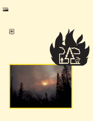
Cover photo—Photo by Roger Ottmar. Smoke blots out the sun during the 1994 Anne Wildfire in western Montana.


Preface

In 1978, a national workshop on fire effects in Denver, Colorado, provided the impetus for the “Effects of Wildland Fire on Ecosystems” series. Recognizing that knowledge of fire was needed for land management planning, state-of-the-knowledge reviews were produced that became known as the “Rainbow Series.” The series consisted of six publications, each with a different colored cover, describing the effects of fire on soil, water, air, flora, fauna, and fuels.

The Rainbow Series proved popular in providing fire effects information for professionals, students, and others. Printed supplies eventually ran out, but knowledge of fire effects continued to grow. To meet the continuing demand for summaries of fire effects knowledge, the interagency National Wildfire Coordinating Group asked Forest Service research leaders to update and revise the series. To fulfill this request, a meeting for organizing the revision was held January 4-6, 1993, in Scottsdale, Arizona. The series name was then changed to “The Rainbow Series.” The five volume series covers air, soil and water, fauna, flora and fuels, and cultural resources.

The Rainbow Series emphasizes principles and processes rather than serving as a summary of all that is known. The five volumes, taken together, provide a wealth of information and examples to advance understanding of basic concepts regarding fire effects in the United States and Canada. As conceptual background, they provide technical support to fire and resource managers for carrying out interdisciplinary planning, which is essential to managing
wildlands in an ecosystem context. Planners and managers will find the series helpful in many aspects of ecosystem-based management, but they will also need to seek out and synthesize more detailed information to resolve specific management questions.

— The Authors
December 2002


Acknowledgments

The Rainbow Series was compiled under the sponsorship of the Joint Fire Science Program,a cooperative fire science effort of the U.S. Department of Agriculture, Forest Service, and the U.S. Department of the Interior, Bureau of Indian Affairs, Bureau of Land Management, Fish and Wildlife Service, National Park Service, and U.S. Geological Survey. Several scientists provided significant input without requesting authorship in this volume. We acknowledge valuable contributions by Sue A. Ferguson, Timothy E. Reinhardt, Robert Yokelson, Dale Wade, and Gary Achtemeier. We also thank the following individuals for their suggestions, information, and assistance that led to substantial technical and editorial improvements in the manuscripts: Scott Goodrick, Allen R. Riebau, Sue A. Ferguson, and Patti Hirami. Finally, we appreciate Marcia Patton-Mallory and Louise Kingsbury for persistence and
support.

CLICK HERE TO DOWNLOAD AS PDF(86 Pages)

Dynamics of an Anthropogenic  Fire Regime

R. P. Guyette,1* R. M. Muzika,1 and D. C. Dey2

1Department of Forestry, 203 Natural Resources Building, University of Missouri, Columbia, Missouri 65211, USA
2USDA North Central Research Station, Columbia, Missouri 65211 USA


ABSTRACT

Human interaction with fire and vegetation occurs at many levels of human population density and cultural development, from subsistence cultures to highly technological societies. The dynamics of these interactions with respect to wildland fire are often difficult to understand and identify at short temporal scales. Dendrochronological fire histories from the Missouri Ozarks, coupled with human population data, offer a quantitative means of examining historic (1680-1990) changes in the anthropogenic fire regime. A temporal analysis of fire scar dates over the last 3 centuries indicates that the percent of sites burned and fire intervals of anthropogenic fires are conditioned by the following four limiting factors: (a) anthropogenic ignition, (b) surface fuel production, (c) fuel fragmentation, and (d) cultural behavior. During an ignition-dependent stage (fewer than 0.64 humans/km2), the percent of sites burned is logarithmically related to human population (r2 0.67). During a fuel-limited stage, where population ensity exceeds a threshold of 0.64 humans/km2, the percent of sites burned is independent of population increases and is limited by fuel production. During a fuel-fragmentation stage, regional trade allows population densities to increase above 3.4 humans/km2, and the percent of sites burned becomes inversely related to population (r2 0.18) as decreases in fuel continuity limit the propagation of surface fires. During a culture-dependent stage, increases in the value of timber over forage greatly reduce the mean fire interval and the percent of sites burned. Examples of the dynamics of these four stages are presented from the Current River watershed of the Missouri Ozarks.

Key words: human population density; Ozarks; Missouri; disturbance; dendrochronology; fire regimes.

CLICK HERE TO DOWNLOAD AS PDF


INTRODUCTION

Anthropogenic, or human-caused, fire has influenced ecosystem processes for millennia, and at broader scales has been an important determinant of landscape character and global carbon cycles (Pyne 1995; Delcourt and Delcourt 1997; Bird and Cali 1998). Despite progress in recent years in understanding how the spatial and temporal dynamics of wildfire shape natural ecosystems (Swetnam 1993; Agee 1993; Whelan 1995), we know little about the ways in which changes in human population and culture alter the use of anthropogenic


Received 24 January 2001; accepted 9 January 2002.
*Corresponding author; e-mail: guyetter@missouri.edu


fire and consequently how that dynamic affects ecosystem pfrocesses and attributes.

Anthropogenic fire occurs throughout a range of human-related activities and settings, from widely scattered  populations living in subsistence cultures to densely settled urban societies; therefore, anthropogenic fire is both temporally and spatially dynamic. Within a region, a temporal dynamic in anthropogenic fire is driven by changes in population and culture that occur over decades and centuries. In North America, dramatic temporal changes in the frequency of anthropogenic fire over the past 400 years have resulted from the displacement of aboriginal cultures and populations by high-density European populations and industrial economies (Pyne 1982; Williams 1989). Human activities strongly influence fire frequencies in such areas as Patagonia (Veblen and others 1999) and the Amazon basin (Kauffman and Uhl 1990); and human populations account for variation in landscape-level fire  egimes in North America (Turner and Romme 1994; Guyette and Dey 2000; Dey and Guyette 2000). In the  Midwest, historical narratives suggesting the use of fire by aboriginal people have been summarized by Ladd (1991), and archacological evidence supports the presence of human populations in Missouri for many thousands of years (Marriott 1974; Price and others 1987; O’Brien and Wood 1998).

Many fire ecologists and historians have defined the concept of fire regime (Pyne 1982; Agee 1993; Whelan 1995; Pyne and others 1996). According to Pyne and others (1996), “A fire regime is intended to characterize the feature of historic, natural fires that have been typical for a particular ecosystem or set of ecosystems.” In many regions, such as the Ozark physiographic province in midwestern North America, human presence on the landscape (O’Brien and Wood 1998) predates contemporary forest-vegetation associations and climatic conditions (Delcourt and Delcourt 1987, 1991); therefore, any characterization of the “natural” fire regime should incorporate all organisms in the ecosystem and all sources of fire, including humans and their ignitions. For the purposes of this analysis, we define an anthropogenic fire regime as patterns of wildland fire shaped by the dynamic interactions of vegetation (fuels) and human populations (ignitions). This definition is functional and consistent with the standard dictionary definition of a regime as “a system of rules”, or in our case, factors that govern the frequency and intensity of fire. Although fire regimes are often defined for specific ecosystems that have a particular combination of vegetation (fuels), climate, and a certain frequency of ignition, the perception that an anthropogenic fire regime is a static combination of these factors may be unrealistic because of the extreme variability in time and space of fluctuating human populations and cultures.

The goal of the research presented here is to demonstrate that change in human population density and culture has been one of the major factors influencing the frequency and effects of wildland fire over the last 320 years in southeastern Missouri. The objectives of this paper are to (a) describe the historic changes in an anthropogenic fire regime; and (b) elucidate the limiting factors that affect these changes through time, including the relationships among human population density, culture, and fuels as determinants of fire regimes. To fulfill these objectives, we used dendrochronological fire histories coupled with data on human population density from AD 1680 to 1998 in the Current River watershed, a topographically highly dissected section of the Ozark Highlands in Missouri, USA.


A Temporal Anthropogenic Framework

The oak-pine forests of the Ozark Highlands offer an appropriate setting to document changes in human-fire interactions over hundreds of years. Schroeder and Buck (1970) estimated that less than one lightning fire per 4000 km2 occurs annually in the Missouri Ozarks. Missouri State Fire Protection records between 1970 and 1989, summarized by Westin (1992), indicate that an average of 108 fires per year per 4000 km2 occurred in the region of the Current River watershed. Of these, less than 1% were of lightning ignition origin; therefore, the overwhelming majority of these fires were caused by humans. The lack of “natural” fires in the Current River region, a temporally variable human population, and variable topography make this region ideal for studying change in anthropogenic fire regimes and its effects on ecosystems. Fire scars from primarily low-intensity surface fires offer high-resolution spatial-temporal data on fire frequency and extent and can be tree-ring-dated on survivor trees and woody remnants (Guyette and McGinnes 1982; Guyette and Cutter 1991; Guyette and Dey 1997a; Jenkins and others 1997). Finally, a highly dissected topography inhibits the propagation of fire, thus making mean fire intervals and the percent of sites burned sensitive to the number and distribution of anthropogenic ignitions. The foregoing evidence suggests a close association between humans and fire in the Ozarks. We hypothesize that identified changes in the percent of sites burned can be attributed to changes in human population density and cultural behavior. Consequently, we propose that a temporal framework can be used to describe these changes. In this analysis, we examine whether fire frequency is a function of ignitions (anthropogenic), fuels, and cultural behavior based on economics and technology.

Study Area

The study area is in the upper Current River watershed (including the Jack Fork River), is heavily forested (more than 80%), and measures about 4316 km2 in area (Figure 1). The study area is located near the western edge of the eastern deciduous forest and is dissected by steep ridges and numerous streams. The slope of the sample sites averages 18° and ranges from 10° to 32°. Elevations in the study area range from 140 to 414 m a.s.l. The climate of the study area is humid and continental. Precipitation ranges from 60 to 152 cm and averages 115 cm per year. Spring is the wettest season, followed by fall, summer, and winter. During the fall, winter, and spring of most years, dry warm weather during only a few days may be sufficient to dry surface fuels and permit the spread of surface fires. Fires during the growing season are rare but do occur during very hot and dry summers. Natural ignition is rare despite an abundance of thunderstorms (50-70 thunderstorm days per year) (Baldwin 1973).

Figure 1. Study area, with fire history sites, historic tree species associations, mean fire intervals, topography, archeological sites, and historic sites. The location of the fire history sites and their mean fire intervals (1700-1850) are indicated by the mapped numbers in black and white. Mean fire intervals in white text represent sites where the interval decreased by more than 10 years during the ignition-dependent stage; mean fire intervals in black indicate a decrease of 0-10 years. The percent of canopy closure defines forests (more than 75%), woodlands (25%-75%), and savannas (less than 25%). Mesic mixed oak-riparian forest is more than 25% mesic species or more than 25% riparian species; mixed oak forest is more than 75% oak and hickory; oak-pine woodland/forest is oak with more than 25% and less than 65% pine; pine savanna/woodland is more than 65% pine; post oak savanna is more than 75% post oak; post oak-black oak savanna is more than 75% post and black oak. Tree species associations are based on General Land Office Survey Notes as interpreted by Porter (1998), Batek and others (1999), and Hughes and Nigh (2000). Archaeological and historic sites are based on data from Price and others (1987), Lynott (1989), and Stevens (1991).


METHODS

Fire History Development

Site locations within the study area were chosen based on the presence of fire-scarred wood, and the majority of fire-scarred wood was found in steep terrain. Thus, the sites are not necessarily truly representative of the area as a whole. Twenty-three of the sites were located in areas dominated historically by oak (Quercus species) forests; four other sites occurred in forests historically dominated by shortleaf pine (Pinus echinata) (Batek and others 1999). Oak has become a dominant species in the overstory of all the fire history sites.

Cross sections of more than 257 shortleaf pine remnants (cut stumps, natural snags, downed trees) were cut between ground level and 30 cm. Wedges were cut from the scar face of live trees. Fire scars were identified by callus tissue, traumatic resin canals, and cambial injury. All samples had charcoal present on the scarred exterior. Scars were dated to the 1st year of cambial injury. Ring-width series from each sample were measured and plotted by year. Ring-width plots were used for visual crossdating (Stokes and Smiley 1968; Guyette and Cutter 1991). The COFECHA computer program (Grissino-Mayer and others 1996) was used to assist in ensuring the accuracy of both relative and absolute dating of the samples by correlation analysis. Absolute dating of the pine remnants was accomplished by cross-dating with a ring-width chronology (Guyette 1996) based on live shortleaf pine growing in Shannon County, Missouri, within the study area. Over 2500 scars were identified and dated from 27 sites. Site-level data  were averaged into a regional composite of the percent of sites burned. An 11-year moving average was applied to percent of sites burned to reduce variability in the time series due to changes in annual climate and to enhance long-term trends in the data. An 11-year moving average was chosen because it preserved variability on a decadal scale, it is symmetrical, and it corresponds to the decadal census data. Correlation coefficients between the percent of sites burned and human population density were calculated without the moving average and were adjusted for autocorrelation in the time series of the percent of sites burned. A representative subset of the data from a site in the study watershed (Figure ) is graphed using FHX2 software (Grissino-Mayer 1995) and illustrates the structure of the data and the changing fire return interval over nearly 4 centuries.

Figure 2. Fire scar data plotted by tree sample and calendar year for a 1-km2 area near Blue Spring along the Current River in Missouri. Each horizontal line represents the tree-ring record of a fire-scarred shortleaf pine tree, stump, or natural snag. Dendrochronologically dated fire scars are represented by vertical lines. A composite fire scar chronology (all fire scar dates) is plotted at the bottom of the graph.


Topographic Roughness

Irregularities in the landscape, or “topographic roughness”, can contribute to the fire behavior in an area of highly dissected topography. The rate of spread of a low-intensity surface fire may decrease because fire burns slower down steep slopes; because fuel continuity is broken by creeks, rivers, and rocky outcrops; or because fuel moisture content increases on northern aspects. Indexes of topographic roughness were used to reflect topographic inhibition of the propagation of fire across the landscape. These indexes were developed by comparing surface area measurements made with two different-sized scales. A circle 5000 m in diameter is marked on a digital elevation map. The surface area of the earth circumscribed by this circle is calculated from pixels that are 30 m on a side. Their slope and a trigonometric conversion are used to estimate the area of the uneven land surface. The pixels are summed to estimate the surface area of the landscape enclosed by the circle. This measure is then divided by the planimetric surface area (the large scale in this case) of a circle that is 5000 m in diameter. This ratio of the actual surface area to the planimetric surface area is the Index of Topographic Roughness. A correlation analysis was used to document changes in the influence of topographic roughness on mean fire intervals by stage of the anthropogenic fire regime.

Human Populations

Population since 1820 was derived for the study area from United States Census data (Shannon County, Missouri) and population estimates and maps in Stevens (1991) and Rafferty (1982). Historic Native American population density was estimated from many sources (Table 1 and references therein). The population density of each group in the Current River watershed was calculated by dividing their historical population estimates by the area of a circle whose radius was the distance between their population center and the watershed. Changes in the location and territory of populations documented in the historical literature were also used to estimate population trends of groups. Although this method does not take into account the great variation of population density within a tribal territory, it does provide an estimate of changes in population density through time that have affected  he population of the Current River watershed. These population density estimates are consistent with aboriginal population densities (0.07-6 humans per km2) given for the Great Lakes region and eastern North America (Kroeber 1934; Dobyns 1983; Ramenofsky 1987; Thornton 1987) and with mapped estimates by Paullin (1932) for the period after 1790. The relative spatial distribution of population within the watershed has remained consistent over time and reflects spatial patterns in past fire occurrence and the recent population of towns (Guyette and Dey 2000). Linear interpolation was used to estimate annual population from decadal census data.


DISCUSSION

The Dynamics and Sequence of the Fire Regime 

A historic and sequential interpretation of fire, human population, and culture (Figure 3) is essential to an understanding of the events that have occurred in the study area over the last 350 years. Although fire historyresearch often ends with the identification of fire intervals and ecological relationships, such findings represent only a first step in identifying the processes and variables underlying changes in ecosystem processes. When population and fire data identical to those in Figure 3 are plotted with axes that are independent of time (Figure 4a), the resulting pattern reflects critical changes in the relationships between humans and the environment (fire). The changing slope and direction of the plotted data reflect four temporal stages that are built upon the interaction among ignitions, fuels, and topography as a function of human population density.

The temporal progression of limiting factors defining these stages in the anthropogenic fire regime involves (a) human ignitions , (b) fuel availability , (c) fire propagation and fuel continuity , and (d) cultural values.  Consequently, these factors define four stages: ignition-dependent, fuel-limited, fuel-fragmentation, and culture-dependent (identified in Figure 4a). All stages are linked to population density in the way that population affects ignitions and fire frequency (the percent of sites burned), as well as the ways in which that relationship is modified by culture. Descriptions of these stages, based on limiting factors and interpretations, follow.

Ignition-dependent (Stage 1). The anthropogenic fire regime is population-dependent during this stage and directly related to human population. Human population density is one of the most important factors in an anthropogenic fire regime, especially in early stages or at low levels of human population density. Consequently, ignition sources are the most limiting factor influencing the percent of sites burned during this period. During this stage (before 1850), low population densities (fewer than 0.64 humans/km2) limited the frequency and distribution of anthropogenic sources of ignition in the Current River watershed. Correlation between percent of sites burned and human population density (nontransformed data) is strongest during this stage (Table 2). Verification of this relationship is demonstrated by a positive nonlinear relationship between the percent of sites burned and human population density. During the ignition-dependent stage, percent of sites burned is related (r2 0.67,  0.01) to the natural logarithm of human population density at low levels (fewer than 0.64 humans/km2) by:

F%    0.32   0.069(ln[P])       (1)

where F% is the percent of sites burned and P is the human population density.

Topographic roughness inhibits the spatial extent and spread of fire during this stage. The degree of topographic roughness and the frequency of fire at each site are inversely correlated (Table 2). Both endogenous and exogenous factors play roles during this stage, since population levels at the study  sites were controlled by local human reproduction, human migration, technological development, and introduced disease (Table 2). This stage is the longest in duration over the past 3 centuries and includes notable fire years (see Appendix).

Table 1. Population Densities (Humans per km2) Estimated and Measured by Decade and Cultural Group


Date All Quapaw Osage Cherokee Delaware Shawnee European
1650 0.047 0.0421a 0.0049f
1660 0.047 0.0421 0.0049
1670 0.050 0.0421 0.0082g
1680 0.052 0.0421 0.0099
1690 0.053 0.0421 0.0115
1700 0.027 0.0139b 0.0132
1710 0.027 0.0126 0.0148
1720 0.038 0.0113 0.0264 0.0001
1730 0.038 0.0084 0.0297 0.0007
1740 0.042 0.0084 0.0331 0.0014
1750 0.045 0.0063c 0.0364 0.0028
1760 0.048 0.0049d 0.0397 0.0041
1770 0.061 0.0044 0.0430h 0.0046l 0.0002n 0.0033r 0.0055
1780 0.1340 0.0039 .0397 0.0185 0.0320 0.0320 0.0082
1790 0.167 0.0034 0.0364i 0.463 0.0320 0.0384 0.0110
1800 0.2210 0.0029 0.0347 0.0927 0.0320 0.0449 0.0137
1810 0.2020 0.0029 0.0331 0.0648 0.0320 0.0513 0.0179
1820 0.662 0.0024 0.0198j 0.0289m 0.3012p 0.0926s 0.2175u
1830 0.371 0.0009e 0.0066 0.0231 0.0033q 0.0926 0.2447
1840 0.294 0.0001k 0.0154 0.0066 0.2719
1850 0.642 0.6420v
1860 0.873 0.8736
1870 0.899 0.8998
1880 1.323 1.3237
1890 3.423 3.4231
1900 4.326 4.3268
1910 4.402 4.4022
1920 4.564 4.5645
1930 4.191 4.1910
1940 4.551 4.5515
1950 3.638 3.6389
1960 2.726 2.7264
1970 2.886 2.8853
1980 3.033 3.0334
1990 3.073 3.0738

The sum of the densities is given in the column labeled “All.” Superscripts refer to source data and type by period.
Not all figures are significant.

aPopulation estimate (Baird 1980)
b,c,dPopulation reductions by disease (Ramenofsky 1987; Baird 1980) eMigration out of the watershed (Baird 1980)
fTerritory just west of Current River (Bailey 1973; Wiegers 1985)
gAcquisition of horse (Wiegers 1985; Waldman 1985)
hMaximum expansion of territory (Bailey 1973; Wiegers 1985)
iPopulation estimates (Marriott 1974; Banks 1978)

jTerritorial reduction (Wiegers 1985) and movement west by treaty (Marriott 1974; Banks 1978) kLast Osage removed from Missouri (Wiegers 1985)
lPopulation estimates, trends, movement into Missouri (Gilbert 1996; Stevens 1991) mMigration to Arkansas (Pitcaithley 1978)
nMovement into east Missouri (Stevens 1991)
oPopulation estimates (Marriott 1974)

pMigration across Missouri River, population estimate, and encampment on the Jacks Fork of the Current River (Weslager 1978) qMovement out of Current River watershed (Stevens 1991; Weslager 1978)
rMovement into east Missouri (Stevens 1991)
sMovement out of southeast Missouri (Howard 1981) tSpanish census data (Gerlach 1986)
uEarly settlement (Stevens 1991)
vShannon County census data (Stevens 1991)

Figure 3. (a) The percent of 26 fire history sites in the Current River watershed that were burned each year (dotted line) and an 11-year moving average of the percent of sites burned annually (solid line) plotted by calendar year. The text above the graph identifies the corresponding cultural periods. (b) A record of the human population density and the population densities of individual cultural groups (see Table 1) in the Current River watershed and the Ozark Highlands (log scale) by calendar year.


Fuel-limited (Stage 2). The anthropogenic fire regime is limited by fuel availability in this stage; within limits, population has no effect. Fire reduces surface fuels in Missouri by more than 50% for up to 2.5 years (Scowcroft 1965). During the fuel limited stage (1850-90), human population exceeded 0.64 humans/km2 in the study area, and the percent of sites burned became independent of in reases in human population density. The percent of sites burned during this stage is limited by the availability and production of surface fuels. Frequent fire created open woodlands with grassy herbaceous understories; therefore, biomass accumulation was limited by the short fire return interval. But by 1850 a threshold in population density (0.64 humans per km2) was reached in terms of burning and fuels wherein the environment became ignition-saturated and the fire regime was fuel limited. The great number of ignitions during this stage nullified the effects of topographic roughness in inhibiting the propagation of fire; hence, topographic roughness became less imporant as a factor controlling fire (Table 2), as illustrated by the lack of significant correlations in stages 2, 3, and 4 of the fire regime. During this stage, endogenous factors that limit fire frequency change from human ignitions to fuel production. This is the shortest of the four stages; it is less than 25% as long as the previous stage. Within the fuel limited stage, a broad range of human population densities can maintain a consistently short fire interval; however, permanent fuel elimination does not characterize this stage.

Figure 4. (a) Scatterplot illustrating the change in the relationship between the percent of sites burned annually and human population density through time. These relationships help to identify the stages in an anthropogenic fire regime. Data points in the scatterplot are labeled with decadal calendar dates to identify the temporal sequence. The scatterplot data are the same data represented by the solid lines in Figure 3a and b. (b) The regional and exogenous population density (state of Missouri) plotted with the percent sites burned during the 20th century contrasts with the endogenous population trends of the Current River watershed.


Table 2. Attributes and Interactions of a Four-phased Anthropogenic Fire Regime


Interactions and Attributes Stage 1: Ignition-dependent (1680-1850) Stage 2: Fuel-limited (1851-90) Stage 3: Fuel-fragmentation (1891-1940) Stage 4: Culture-dependent (1940-90)
Key Factors Limiting Fire Number of human ignitions Amount and production of fuel Discontinuity of fuels,propagation of fire Cultural attitude, fire suppression, value of wood over forage
Origin and Examples of
Factors that Influence
Development
Endogenous: human population
change
Exogenous: human migration,
introduced
Endogenous: fuel
production, ignition
saturation
Endogenous: fuel continuity,
human incursions
Exogenous: regional
economics, resource
exploitation
Exogenous: cultural value
of forests, value of
timber versus forage
Population (humans km          2) <0.03-0.64 0.64-3.4 3.4-4.6 4.6-2.7
Average and Range of
Mean
10 (2.3-45) 3.5 (1.5-6.8) 5.8 (1.7-19) >20 (6.8-50)
Mean and Range (PercentSites Burned Annually)b 12 (0-60) 38 (10-55) 29 (0-51) 10 (0-32)
Correlation (Population,Percent Sites Burned) r =0.63, P <0.01 r =0.05, P> 0.05 r =0.30, P >0.05 r =0.52, P <0.01
Culture (price ratio: (timber/livestock) Insufficient data 2.1 4.3 7.2
Correlation: (Topography and Mean Fire Interval)c (1580–1700) r= 0.71
(1701–1850)r=        0.43 P< 0.05
r = 0.14, P>  0.05 r =0.15, P> 0.05 Insufficient data
Ca in Woodb  (  g/g) 678 755 700 650
Pine Abundanced Culture and Land Use 51 stems per ha Aboriginal American, hunting,and gathering Euro-American settlement and agriculture 17 stems per ha Euro-American, logging,grazing, and agriculture American, forestry, recreation, and agriculture

aGuyette and Cutter 1997; Batek and others 1999
bGuyette and Cutter 1997
cGuyette and Dey 2000
dGuyette and Dey 1997b

Table 3. Agricultural Statistics Indicating Increases in Land Uses that Fragmented the Continuity of the Surface Fuel Environment Between Stage 2 and Stage 3a


Decade Hogs per km2 Cattle per km2 Improved landa(%)
1850 0.87 0.38 1.3
1860 2.5 1.8 2.2
1870 4.1 1.7 2.2
1880 8.6 2.2 6.3
1890 7.8 5.2 11.6
1900 8.4 2.6 14.2
1910 8.1 7.3 17.5
1920 6.6 8.4 19.7
1930 4.0 7.4 17.2
1940 6.2 7.3 26.7

a“Improved land” includes pasture fenced land, orchards, crops, and fallow fields (Jacobson and Primm 1997).

Fuel-fragmentation (Stage 3). During the fuel fragmentation stage (1890-1940), regional trade, railroads, and markets allowed population densities to increase above 3.4 humans/km2. A peak in human population density within the watershed (about 4.6 km2) was reached in the 1920s. Increases in human population density led to increases in the number of artificial fuel breaks caused by livestock grazing, road building, and the conversion of field and forest to crop land and pasture (Table 3). This development led in turn to a reduction in the percent of sites burned because it inhibited the propagation of low-intensity surface fires, the mode of fire in the previous two stages. The percent of sites burned became inversely related to population density (r2 0.18, P 0.05) because the continuity of wildland fuels became fragmented by agricultural and rural development. A decrease in the percent of sites burned coincided with increasing population density between 1890 and 1940. Thus, the percent of sites burned, once a function of the ability of fires to spread and increase in size, was limited by the decreased propagation of surface fires across the ndscape due to fragmentation of the fuel environment. The fragmentation stage can be followed in subsequent stages by the elimination of wildland  uels, as might occur through urban or agricultural development.

Culture-dependent (Stage 4). During this stage, cultural values, practices, and technology influence human nvironmental interactions. Cultural attitudes toward the benefits, costs, and dangers of wildland fire are second only to gross population density in importance to anthropogenic fire regimes. During the culture-dependent stage (1940- 96), increases in the value of timber (to a growing exogenous human population) (Figure 4b) relative to that of pasture resulted in attitudes and cultural constructs that reduced the frequency of fire. The price ratio of wood products (Anonymous 1965; Gregory 1972) to livestock (data provided by the Missouri Agricultural Statistical Service) was highly correlated with the percent of sites burned and probably reflects changes in attitudes about the value of forests versus livestock range. The low forage value of forest lands for livestock and increasing demand for wood products were important factors that inspired education on the economic destructiveness of wildland fire, the desire to protect forested lands, and the institution of fire suppression over the last 60 years in the Ozark Highlands.

Attributes of the Stages

Throughout all four of the stages of the anthropogenic fire regime, the factors that limit fire change along the temporal framework. Both causal and resulting factors exert varying influences on the character of the fire regime, depending on the stage. We have identified several components of the anthropogenic fire regime that figure prominantly in determining the stage or represent a substantial response in any or all stages. Although the implications of changing fire regimes are numerous, we  will focus here on a few interactions, effects, and attributes that are useful in elucidating the complexity of the human-fire interaction.

Endogenous and Exogenous Factors. A classification of important endogenous and exogenous factors by stage (Table 2) shows that endogenous factors predominate in early stages, and that exogenous factors become more important in later stages. For the purposes of this perspective, we consider humans to be an integral part of the Current River ecosystem; therefore, anthropogenic factors within the ecosystem are endogenous, and anthropogenic factors outside the ecosystem are exogenous. Significant endogenous factors during early stages include indigenous human population growth and technological innovation. Introduced diseases, however, were a major exogenous factor during the ignition-dependent stage. Endogenous factors pertinent in the early stages of development include fuel abundance, fuel type, and vegetative change and succession. The fuel-limited stage is the only stage where there are no important contributions by exogenous factors. Exogenous factors resulting from human population changes, predominantly migration and population growth, contribute to the fuel-fragmentation and culture dependent stages. Throughout the stages, the change from endogenous to exogenous influence is accompanied by increases in human population, transportation, and communication.

Vegetation-Fire Interactions. There are several tree species that provide particularly useful evidence of the effects of the stages of the fire regime on vegetation because of their longevity and fire sensitivity. Using data compiled from land survey records (circa 1830), the mean fire interval at 23 sites (Batek and others 1999) in the Current River watershed was positively and significantly correlated with the abundance of Pinus echinata and neg atively correlated with the abundance of Quercusvelutina (black oak). These relationships imply that fire frequency may have been a factor influencing vegetation during stage 1 (Table 2). Reductions in the mean fire interval during stages 2 and 3 (1820- 1940) to near annual burning in some areas (Guyette and Cutter 1997), combined with the logging of pine, may have inhibited pine regeneration, reduced the abundance of advanced (prelogging) reproduction, and decreased the amount of mature pine (Record 1910). Currently, pine abundance is only 34% of its historic levels in some areas of the Current River watershed (Guyette and Dey 1997a).

The past and present distribution of Juniperus virginiana (eastern redcedar), a fire-sensitive species, may reflect the intensity and frequency of fires during the ignition-dependent stage. Circa 1840, surveyors noted redcedar on sites with long fire intervals but made no mention of redcedar on sites with a short fire interval (Batek and others 1999). Old (200 years) redcedar persist to the present day on sites that had longer fire intervals during the ignitionependent stage, as documented by the fire scar record. In contrast, there are no old and few young eastern redcedar on sites that had short fire intervals during the ignition-dependent stage. Abundance of Quercus stellata (post oak), a fire-tolerant and shade-intolerant species, as determined from surveyor notes, is significantly correlated with mean fire intervals during the ignition-dependent stage. The ignition-dependent stage has the greatest spatial and  temporal variability in the percent of sites burned and mean fire intervals (Table 2); it is the disturbance regime under which recent vegetation associations have developed for centuries.

Figure 5. Scatterplots illustrating the similarity in pattern between the percent sites burned and heartwood calcium concentration (Juniperus virginana) as related to human population density. Labels on the graph data points represent bidecadal calendar years.


Stage-related Calcium Dynamics. Wildland fire is a chemical process that can cause sudden changes in the nutrient status of a site. Calcium (Ca) is a necessary plant macronutrient whose bioavailability has been shown to increase after fires (DeBano and others 1977; Zinke 1977; Agee 1993) and over longer periods by increasing the rate of Ca cycling in organic debris that is frequently burned (Alban 1977; Binkley and others 1992). An association between trends in Ca availability and mean fire intervals over a 340-year period was inferred from Ca in growth increments of eastern redcedar heartwood growing in the Current River watershed (Guyette and Cutter 1997). Although eastern redcedar is a fire-sensitive species, old individuals of this species persist where they have some protection from the lethal effects of fire—for example, on rhyolite glades, where there is extensive barren rock surface and fire intensity is low. In addition, eastern redcedar has many anatomical and ecological characteristics uniquely suited for dendrochemical studies (Cutter and Guyette 1993) and has been used to reconstruct many changes in environmental chemistry (Guyette and others 1989, 1991, 1992; Guyette and Cutter 1994).

The association between heartwood Ca and human population density (Figure 5) suggests that the stages of the fire regime may have different effects on nutrient cycling. The Ca chronology of dated redcedar heartwood increments was highly correlated with the 20-year grouped means of the percent of sites burned (r 0.81) and trees scarred(r 0.77). During the ignition-dependent stage,Ca is variable and increases steadily with small increases in human population density. Ca concentrations in the heartwood are highest during the fuel-limited stage, the period with the lowest mean fire interval and the greatest percent of sites burned (Table 2). During this stage, the availability of Ca increases owing to the release of Ca in organic litter by the rapid abiotic decomposition mechanism of frequent low-intensity fires. As fire frequency declines in subsequent stages, Ca concentrations decrease in wood.

Human Population Density and Topographic Interactions. Certain stages in an anthropogenic fire regime are the result of complex interactions between human population density and topographic roughness. At low population densities, the percent of sites burned increases with population density (Fig ure 4a). Topographic  controls on the frequency of fire become less important as population density and the frequency and distribution of anthropogenic ignitions increases (Table 2). The forcing factor of the ignition-dependent and fuel-limited stages is the interaction of human population density and topographic roughness. A topographically smooth landscape, such as a large plain or plateau (often prairies), might require only a few humans to reach and maintain a fuel-limited stage. On the other hand, many topographically rough landscapes, such as forests in the Ozark Highlands, require a relatively high human population density to reach and maintain a fuel-limited stage.

Culture and Fire Stages. In the later stages that we have identified, factors controlling the regime change from environmental to cultural. Fuel and local human population density, possibly irrespective of ignition motivation, govern the fire regime in the early stages. Subsequently, during the fuel fragmentation stage, cultural artifacts—such as roads and agricultural development—begin to affect the spread, frequency, and size of fires. Artificial fire breaks in an ignition-saturated environment are now replacing the natural role of topographic roughness as an inhibitor of the spread of fire. Economic values, coupled with the technology of fire suppression, become dominant during the cultural-dependent stage and account for the lowest frequency of fire across all stages.

Human Risk and Fire Stages. The culture-dependent stage may be unstable. During this stage, the cultural separation of ignitions and fuels continues to have increasingly serious implications for human societies that live in environments with highly volatile fuels, particularly those with growing human populations. The accumulation of fuel, ignition potential, and increasing human occupation of the landscape act together to increase the potential risk to human life and property. The most important factors affecting the dynamics of the stages and their associated risk to human life and property are conceptualized using the dynamic interactions of humans and fuels (Figure 6a, b, c). Using a theoretically extended temporal framework, we developed a conceptual model to examine the overall risk to humans (Figure 6d).

Figure 6. Theorized time series of factors influencing the dynamics of the stages of the fire regime (a, b, c). The
variables associated with each of the stages include I: human population density, Fa: total surface fuel accumulation, and Fc: relative fuel continuity. The conceptual model of risk (d) to humans, based on calculations from the formula presented, represents the contribution of these three variables.


The square of human population density is the dominant variable in this model. The exponential nature of this variable is derived from the dual effect of human population density on fire regimes. One significant effect is that increases in human population density increase ignition potential; the other effect is that higher human population density across the landscape increases the likelihood that wildland fire will damage human life and property. Fuel fragmentation is the only physical factor in this conceptual model of risk that reduces the risk of wildland fire for humans. Fuel fragmentation, however, may be outweighed by the exponential effects of human population and the accumulation of fuels.

SYNTHESIS

Dendrochronological histories allow the quantitative analysis of the role of humans in an ecosystem and show that this role is part of an ecological dynamic controlled by changes in factors that limit the occurrence of fire. Temporal trends in the percent of sites burned and human population density, coupled with historic information on human cultures, allow us to define four stages within an anthropogenic fire regime in the Current River watershed in Missouri.

The stability of any stage in the fire regime is dependent on exogenous human-related factors—for example, war, migration, and introduced disease—as well as changes in endogenous factors, such as fuel accumulation. Some stages may persist and appear to be somewhat stable. In North America, for example, the culture-dependent stage may be a prolonged endpoint under continued fire suppression. The apparent stability of this stage, however, is subject to stochastic phenomena—for example, extreme climate events, which could result in catastrophic or frequent fires. The separation of ignitions and fuels (fire suppression) that occurs during a culture-dependent stage creates an inherently unstable condition.

Fire histories reveal many examples of the influence of exogenous human-related factors on the initiation and termination of anthropogenic fire stages. In Patagonia, the link between humans and fire frequency suggests a sequence of human-fire interactions wherein climatic influences are significant in determining fire frequency on a short-term basis, but the role of humans is significant when examined over decades and centuries (Veblen and others 1999). Bird and Cali (1998) have presented evidence of fire from sediments that demonstrates the influence of humans on fire regimes in sub Saharan Africa over a time scale of hundreds of thousands of years. Charcoal accumulation rates from sediments in the southern Appalachian Mountains also suggest a strong correspondence between human population density (based on the number of archaeological sites) and fire (based on charcoal accumulation) (Delcourt and Delcourt 1997).

The extension of these stages to other ecosystems has limitations. Topographic roughness mitigates the spread of fire and is an integral component of the stages we have identified in our landscape. The effect of human ignitions could be mitigated by topographic roughness or the frequency of water bodies, nonvegetated lands, or other natural fire breaks. Guyette and Cutter (1991) described the fire histories of an oak savanna in Missouri where continuous fine fuels contributed to a consistent mean fire interval, with no population effect evident before Euro-American  settlement. Few ignitions are needed in topographically uniform areas (for example, plains or plateaus) for fires to propagate; therefore, fire frequency tends to be independent of human population density. For example, Abrams (1985) found no indication of distinct stages in the fire history of an oak gallery forest in northeastern Kansas. Sufficient topographic inhibition of the spread of fire is necessary for an ignitiondependent stage in an  anthropogenic fire regime.

We think that the four stages identified by our research could be used as a temporal model to describe and characterize other ecosystems. For example, Amazonia may typify an area in the ignition-dependent stage because population density is closely linked with fire frequency (Laurance 1998). In Australia, many ecosystems may have attributes of a fuel-limited stage (Pyne 1991). Moreover, tropical savanna and brush lands burn frequently, and these fires often result from human ignitions (Andreae 1991). More rigorous analysis of the dynamic interactions among human population density, fuels, and culture could thus enhance our understanding of change and process in ecosystems.

ACKNOWLEDGMENTS

We thank the Missouri Ozark Forest Ecosystem Project, the Missouri Conservation Department, the National Park Service, and the US. Forest Service North Central Station for their support. We are grateful to the Ozark National Scenic Riverways and Charles Putnam for field support. We thank John Krstansky, Tim Nigh, and Mike Stambaugh
for their contributions to the concept of topographic roughness and their expertise in mapping.

REFERENCES

Abrams MD. 1985. Fire history of oak gallery forest in a north eastern Kansas tallgrass prairie. Am Midl Nat 114:188-91.

Agee JK. 1993. Fire ecology of the Pacific Northwest. Washington (DC): Island Press. 493 p.

Alban DH. 1977. Influence on soil properties of prescribed burning under mature red pine. USDA Forest Service ResearchPaper NC-139. North Central Forest Experiment Station, St. Paul, Minn.

Andreae MO. 1991. Biomass burning: its history, use, and distribution and its impact on environmental quality and globalclimate. In: Levin JS, editor. Global biomass burning: atmosphere, climate, and biosphere. Cambridge (MA): MIT Press. p3-21.

Anonymous. 1965. Timber trends in the United States. Forest Resource Report No. 17. Washington (DC): US Government Printing Office. 235 p.

Bailey GA. 1973. Changes in Osage social organization 1673-1906. Anthropological Papers, No. 5. Eugene (OR): University of Oregon.

Baird WD. 1980. The Quapaw Indians: a history of the downstream people. Norman (OK): University of Oklahoma Press. 290 p.

Baldwin JL. 1973. Climates of the United States. Washington (DC): US Department of Commerce, National Oceanic and Atmospheric Administration, Environment Data Service.113 p.

Banks A. 1978. Indians of the upper Current River. Eminence (MO): Alan Banks. 87 p.

Batek MJ, Rebertus AJ, Schroeder WA, Haithcoat TL, Compas E, Guyette RP. 1999. Reconstruction of early nineteenth century vegetation and fire regimes in the Missouri Ozarks. J Biogeogr 26:397-412.

Binkley D, Richter D, David MB, Caldwell B. 1992. Soil chemistry in a loblolly/longleaf pine forest with interval burning.Ecol Appl 2:157-64.

Bird MI, Cali JA. 1998. A million-year record of fire in sub Saharan Africa. Nature 394:767-76.

Cook ER, Meko DM, Stahle DW, Cleaveland MK. 1999. Drought reconstructions for the continental United States. J Clim 12: 1145-62.

Cutter BE, Guyette RP. 1993. Factors affecting species choice for dendrochemistry studies. J Environ Qual 22:611-9.

Cutter BE, Guyette RP. 1994. Fire history of an oak-hickory ridge top in the Missouri Ozarks. Am Midl Nat 132:393-8. Cwynar LC. 1977. The recent fire history of Barron Township, Algonquin Park. Can J Bot 55:1524-8.

DeBano LF, Dunn PH, Conrad CE. 1977. Fire’s effect on physical and chemical properties of chaparral soils. In: Mooney H, Conrad C, Tech. Coord. Proceedings of the symposium on the environmental consequences of fire and fuel management in Mediterranean ecosystems. Forest Service General Technical Report WO-3. Washington, D.C. US Department of Agriculture. p 65-74.

Delcourt HR, Delcourt PA. 1991. Late-quaternary vegetation history of the interior highlands of Missouri, Arkansas, and Oklahoma. In: Henderson D, Hedrick LD, editors. Restoration of old growth forests in the interior highlands of Arkansas and Oklahoma. Proceedings of the Conference Winrock International. Morrilton (AR): Winrock  International Institute for Agricultural Development. 15-30.

Delcourt PA, Delcourt HR. 1987. Long-term forest dynamics of the temperate zone. New York: Springer-Verlag. 439 p.

Delcourt HR, Delcourt PA. 1997. Pre-Columbian Native American use of fire on southern Appalachian landscapes. Conserv Biol 11:1010-014.

Dey DC, Guyette RP. 2000. Anthropogenic fire history and red oak forests in south-central Ontario. For Chron 76:339-47.

Dobyns HF. 1983. Their number become thinned. Knoxville (TN): University of Tennessee Press. 378 p.

Foley WE. 1999. A history of Missouri; vol. 1 Columbia (MO): University of Missouri Press. 249 p.

Gerlach RL. 1986. Settlement patterns in Missouri. Columbia (MO): University of Missouri Press. 88 p.

Gilbert J. 1996. The Trail of Tears across Missouri. Columbia (MO): University of Missouri Press. 122 p.

Gregory GR. 1972. Forest resource economics. New York: Wiley. 548 p.

Grissino-Mayer HD. 1995. Fire and climate reconstructions at El Malpais National Monument, New Mexico [dissertation]. Tucson (AZ): University of Arizona. 407 p.

Grissino-Mayer HD, Holmes RL, Fritts HC. 1996. International Tree-Ring Data Bank Program Library user’s manual. Version 2.0. Tucson (AZ): Laboratory of Tree-Ring Research. 106 p.

Guyette RP. 1996. Tree-ring data, Ontario and Missouri. International Tree-Ring Data Bank. IGBP PAGES/World Data Center-A for Paleoclimatology Data Contribution Series No. 92-014. Boulder (CO): National Oceanic and Atmospheric Admin./National Geophysical Data Center Paleoclimatology Program.

Guyette RP, Cutter BE. 1994. Barium and manganese trends in tree-rings as monitors of sulfate deposition. J Water Air Soil Poll 73:213-23.

Guyette RP, Cutter BE. 1997. Fire history, population, and calcium cycling in the Current River watershed. In: Pallardy S, Cecich R, Garrett H, Johnson P, editors. Proceedings of the 11th Central Hardwood Forest conference. Forest Service General Technical Report NC-188. St. Paul (MN): US Department of Agriculture. p 355-73.

Guyette RP, Cutter BE. 1991. Tree-ring analysis of fire history of a post oak savanna in the Missouri Ozarks. Nat Areas J 11:  93-9.

Guyette RP, Cutter BE, Henderson GS. 1989. Long-term changes in molybdenum and sulfur concentrations in redcedar treerings. J Environ Qual 18:385-9.

Guyette RP, Cutter BE, Henderson GS. 1991. Long-term correlations between mining activity and levels of lead and cadmium in tree-rings of redcedar. J Environ Qual 20:146-50.

Guyette RP, Cutter BE, Henderson GS. 1992. Reconstructing soil pH from manganese concentrations in tree-rings. For Sci 38: 727-37.

Guyette RP, Dey DC. 1995a. A dendrochronological fire history of Opeongo Lookout in Algonquin Park, Ontario. Forest. Research. Report No. 134. Sault Ste. Marie (Ont.): Ontario Forest Research. Institute. 4 p.

Guyette RP, Dey DC. 1997a. A fire history of Huckleberry Hollow. Forest Research. Paper No. 1. Jefferson City (MO): Missouri Department of Conservation. 10 p.

Guyette RP, Dey DC. 1997b. Historic shortleaf pine (Pinus echinata Mill.) abundance and fire frequency in a mixed oak-pine forest. In: Brookshire B, Shifley S, editors. Proceedings of the Missouri Ozark Forest ecosystem project symposium. USDA Forest Service General Technical Report NC-193. St. Paul (MN): US Department of Agriculture. p 136-49.

Guyette RP, Dey DC. 2000. Humans, topography, and wildland fire: the ingredients for long-term patterns in ecosystems. In: Yaussy D, editor. Proceedings: workshop on fire, people, and the Central Hardwoods landscape. USDA Forest Service General Technical Report NE-274. US Department of Agriculture. Newton Square (PA): p 28-35.

Guyette RP, Dey DC. 1995b. A presettlement fire history in an oak-pine forest near Basin Lake, Algonquin Park, Ontario. Forest. Research. Report No. 132. Sault Ste. Marie (Ont.): Ontano Forest Research Institute. 11 p.

Guyette RP, McGinnes EA. 1982. Fire history of an Ozark glade. Trans Missouri Acad Sci 16:85-93.

Heinselman ML. 1981. Fire intensity and frequency as factors in the distribution and structure of northern ecosystems. In: Mooney and others, Tech. Coord. Proceedings on fire regimes and ecosystem properties, Honolulu, HI. 11-15, December 1978. Forest Service General Technical Report WO-26. Washington (DC): US Department of Agriculture. p 5-57.

Howard JH. 1981. Shawnee: the ceremonialism of a native Indian tribe and its cultural background. Athens (OH): Ohio University Press. 454 p.

Hughes LG, Nigh TA. 2000. Historic vegetation of Missouri,lower Ozarks Pilot Area. Jefferson City (MO): Missouri Department of Conservation.

Jacobson RB, Primm AT. 1997. Historical land-use changes and potential effects on stream disturbance in the Ozark Plateaus, Missouri. Water-Supply Paper 2484. Denver (CO): US Geological Survey. 85 p.

Jenkins SE, Guyette RP, Rebertus AJ. 1997. Vegetation diversity and fire history on Turkey Mountain. In: Pallardy S, Cecich R, Garrett H, Johnson P, editors. Proceedings of the 11th Central Hardwood Forest conference. Forest Service General Technical Report NC-188. St. Paul (MN): US Department of Agriculture. p 184-201.

Kauffman JB, Uhl C. 1990. Interactions of anthropogenic activities, fire, and rain forests in the Amazon basin. Ecol Stud: Anal and Synth 84:117-34.

Kroeber AL. 1934. Native American population. Am Anthropol 36:1-25.

Ladd D. 1991. Reexamination of the role of fire in Missouri oak woodland. In: Burgur G, Ebinger J, Wilhem G, editors. Proceedings of the oak woods management workshop. Charleston (IL): Eastern Illiniois University p 67-80.

Laurance WF. 1998. A crisis in the making: responses of Amazonian forests to land use and climate change. Trends Ecol Evol 13:411-15.

Lynott MJ. 1989. An archeological evaluation of the Gooseneck and Owls Bend sites: Ozark National Scenic Riverways, southeast Missouri. Conducted for the US Department of the Interior, National Park Service, Midwest Archeological Center. Lincoln (NE) Center of Archaeological Research, Southwest Missouri State University

Marriott A. 1974. Osage Indians II. New York: Garland. 270 p. O’Brien MJ, Wood WR. 1998. The prehistory of Missouri. Columbia (MO): University of Missouri Press. 417 p.

Paullin CO. 1932. Atlas of the historical geography of the United States. Carnegie Institute of Washington and the American Geographical Society of New York. Washington (DC) 166 p.

Pitcaithley DT. 1978. Let the river be: a history of the Ozark’s  Buffalo River. Santa Fe (NM): Southwest Cultural Resources Center, National Park Service. 133 p.

Porter SR. 1998. Modeling historic woody vegetation in the lower Ozarks of Missouri [thesis]. Columbia (MO): University of Missouri. 134 p.

Price JE, Price CR, Saucier R. 1987. Archeological investigations in the Ozark National Scenic Riverways, 1984-1986. Conducted for the US Department of the Interior, National Park Service, Midwest Archeological Center. Lincoln (NE): Center of Archaeological Research, Southwest Missouri State University, Springfield (MO) 169 p.

Pyne SJ. 1991. Burning bush. New York: Holt. 520 p.

Pyne SJ. 1982. Fire in America. Princeton (NJ): Princeton University Press. 654 p.

Pyne SJ. 1995. World fire: the culture of fire on earth. New York: Holt. 379 p.

Pyne SJ, Andrews PL, Laven RD. 1996. Introduction to wildland fire. New York: Wiley. 769 p.

Rafferty MD. 1982. Historical atlas of Missouri. Norman (OK): University of Oklahoma Press. 113 p.

Ramenofsky AF. 1987. Vectors of death: the archaeology of European contact. Albuquerque (NM): University of New Mexico Press. 300 p.

Record SJ. 1910. Forest conditions of the Ozark region of Missouri. Bulletin No. 89. Columbia (MO): Missouri Agriculture Experiment Station.

Schroeder MJ, Buck CC. 1970. Fire weather. Agricultural Handbook 360. Washington (DC): US Department of Agriculture, Forest Service. 229 p.

Scowcroft PG. 1965. The effects of fire on the hardwood forest of the Missouri Ozarks [thesis]. Columbia (MO): University of Missouri. 126 p.

Shumway DL, Abrams MC, Ruffner CM. 2001. A 400-year history of fire and oak recruitment in an old-growth oak forest in western Maryland, U.S.A. Can J For Res 31:1437-43.

Stevens DL. 1991. A homeland and a hinterland: the Current and Jacks Fork riverways. Historic Resource Study, Ozark National Riverways. Van Buren (MO): National Park Service. 248 p.

Stokes MA, Smiley TL. 1968. Introduction to tree-ring dating. Chicago (IL): University of Chicago Press. 78 p.

Swetnam TW. 1993. Fire history and climate change in GiantSequoia groves. Science 262:886-9.

Thornton R. 1987. American Indian holocaust and survival.Norman (OK): University of Oklahoma Press. 292 p.

Turner MG, Romme WH. 1994. Landscape dynamics in crown fire ecosystems. Landscape Ecol 9:59-77.

Veblen TT, Kitzberger T, Villalba R, Donnegan J. 1999. Fire history in northern Patagonia: the roles of humans and climatic variation. Ecol Monogr 69:47-67.

Waldman C. 1985. Atlas of the North American Indian. New York: Facts On File. 276 p.

Weslager CA. 1978. The Delaware Indian westward migration. Wallingford (PA): Middle Atlantic Press. 266 p.

Westin S. 1992. Wildfire in Missouri. Jefferson City (MO): Missouri Department of Conservation. 161 p.

Whelan RJ. 1995. The ecology of fire. New York: Cambridge University Press. 346 p.

Wiegers RP. 1985. Osage culture change inferred from contact and trade with the Caddo and the Pawnee [dissertation]. Columbia (MO): University of Missouri. 229 p.

Williams M. 1989. Americans and their forests: a historical geography. New York: Cambridge University Press. 599 p.

Wolferman KC. 1997. The Osage in Missouri. Columbia (MO): University of Missouri Press. 119 p.

Zinke PJ. 1977. Mineral cycling in fire-type ecosystems. In: Proceedings of the symposium on the environmental Consequences of fire and fuel management in Mediterranean ecosystems. Forest Service General Technical Report WO-3. Washington (DC) US Department of Agriculture. 498 p.

Appendix. The Fires of 1780

Dendrochronological evidence suggests the occurrence of extensive, and possibly intensive, fires in at least three areas of eastern North America during 1780, a year of drought and increasing human turmoil. In the Algonquin Highlands of southern Ontario, sites over an area of 2000 km2 show evidence of fire in 1780 (Cwynar 1977; Dey and Guyette 2000a). At two of these Algonquin sites, 66% and  43% of the trees were scarred, indicating that surface fires must have been intense (Guyette and Dey 1995a, 1995b). In Missouri, 43% of the study sites in the Current River watershed were burned and 28% of the sample trees were scarred along the North Fork of the White River; evidence of fire in the same year was also found near the Gasconade River (Cutter and Guyette 1994). Along the breaks of the Arkansas River in the Boston Mountains, trees at three sites separated by 15 km had scars formed in 1780 (R. P. Guyette and M. Spetich unpublished). In addition, fires occurred circa 1780 in Minnesota (Heinselman 1981) and Maryland (Shumway and others 2001). The extent and severity of these fires was probably the result of a drought in 1780 (Cook and others 1999) coupled with concurrent human activities. Human conflict frequently results in wildland fire. Eastern Native American tribes were forced west and north into areas not yet populated by Euro-Americans circa 1780 and were often in conflict with the indigenous tribes they encountered such as the Osage in the Ozarks (Stevens 1991; Wolferman 1997). Spain declared war on England in 1779. By May 1780, the English, Menominee, and Winnebago were attacking the Spanish colony of St. Louis, Missouri (Foley 1999). There was a considerable struggle among the Americans, French, Osage, Cherokee, Spanish, and English for the control of trade in Missouri. Thus, a combination of human activities and drought probably resulted in one of the worst fire years of the 1700s.

Wildland Fire in Ecosystems Effects of Fire on Flora

General Technical Report RMRS-GTR-42-volume 2
December 2000


Abstract

Brown, James K.; Smith, Jane Kapler, eds. 2000. Wildland fire in ecosystems: effects of fire on flora. Gen. Tech. Rep. RMRS-GTR-42-vol. 2. Ogden, UT: U.S. Department of Agriculture, Forest Service, Rocky Mountain Research Station. 257 p.

This state-of-knowledge review about the effects of fire on flora and fuels can assist land managers with ecosystem and fire management planning and in their efforts to inform others about the ecological role of fire. Chapter topics include fire regime classification, autecological effects of fire, fire regime characteristics and postfire plant community developments in ecosystems throughout the United States and Canada, global climate change, ecological principles of fire regimes, and practical considerations for managing fire in an ecosytem context.

Keywords: ecosystem, fire effects, fire management, fire regime, fire severity, fuels, habitat, plant response, plants, succession, vegetation.


Editors

James K. Brown, Research Forester, Systems for Environmental Management, Missoula, MT 59802 (formerly with Fire Sciences Laboratory, Rocky Mountain Research Station, U.S. Department of Agriculture, Forest Service).

Jane Kapler Smith, Ecologist, Fire Sciences Laboratory, Rocky Mountain Research Station, U.S. Department of Agriculture, Forest Service, Missoula, MT 59807.

Authors

R. James Ansley, Plant Physiologist, Texas A&M University  System, Texas Agricultural Experiment Station, Vernon, TX  76385

Stephen F. Arno, Research Forester (Emeritus), Fire Sciences Laboratory, Rocky Mountain Research Station, U.S.
Department of Agriculture, Forest Service, Missoula, MT 59807

Brent L. Brock, Research Associate, Division of Biology, Kansas State University, Manhattan, KS 66506

Patrick H. Brose, Research Forester, Northeastern Research Station, U.S. Department of Agriculture, Forest Service, Irvine, PA 16329

James K. Brown, Research Forester, Systems for Environmental Management, Missoula, MT 59802 (formerly with Fire Sciences Laboratory, Rocky Mountain Research Station, U.S. Department of Agriculture, Forest Service)

Luc C. Duchesne, Research Scientist, Canadian Forestry Service, Great Lakes Forestry Centre, Sault Ste Marie, ON P6A 5M7

James B. Grace, Research Ecologist, National Wetlands Research Center, U.S. Geological Survey, Lafayette, LA 70506

Gerald J. Gottfried, Research Forester, Southwest Forest Sciences Complex, Rocky Mountain Research Station, U.S. Department of Agriculture, Forest Service, Flagstaff, AZ 86001

Sally M. Haase, Research Forester, Riverside Forest Fire Laboratory, Pacific Southwest Research Station, U.S. Department of Agriculture, Forest Service, Riverside, CA 92507

Michael G. Harrington, Research Forester, Fire Sciences Laboratory, Rocky Mountain Research Station, U.S. Department of Agriculture, Forest Service, Missoula, MT 59807

Brad C. Hawkes, Fire Research Officer, Canadian Forestry Service, Pacific Forestry Centre, Victoria, BC V8Z 1M5

Greg A. Hoch, Graduate Research Assistant, Division of Biology, Kansas State University, Manhattan, KS 66506

Melanie Miller, Fire Ecologist, Bureau of Land Management, National Office of Fire and Aviation, Boise, ID 83705

Ronald L. Myers, Director of National Fire Management Program, The Nature Conservancy, Tall Timbers Research Station, Tallahassee, FL 32312

Marcia G. Narog, Ecologist, Riverside Forest Fire Laboratory, Pacific Southwest Research Station, U.S. Department of Agriculture, Forest Service, Riverside, CA 92507

William A. Patterson III, Professor, Department of Forestry and Wildlife Management, University of Massachusetts, Amherst, MA 01003

Timothy E. Paysen, Research Forester, Riverside Forest Fire Laboratory, Pacific Southwest Research Station, U.S. Department of Agriculture, Forest Service, Riverside, CA 92507

Kevin C. Ryan, Project Leader of Fire Effects Unit, Fire Sciences Laboratory, Rocky Mountain Research Station, U.S.
Department of Agriculture, Forest Service, Missoula, MT 59807

Stephen S. Sackett, Research Forester (Emeritus), Riverside Forest Fire Laboratory, Pacific Southwest Research Station, U.S. Department of Agriculture, Forest Service, Riverside, CA 92507

Dale D. Wade, Research Forester, Forestry Sciences Laboratory, Southern Research Station, U.S. Department of Agriculture, Forest Service, Athens, GA 30602

Ruth C. Wilson, Professor of Biology, California State University, San Bernardino, CA 92407


Cover photo—Arnica and fireweed flowers, Bob Marshall Wilderness, MT, 2 years after crown fire. Photo by Melanie Miller.


Preface

In 1978, a national workshop on fire effects in Denver, Colorado, provided the impetus for the “Effects of Wildland Fire on Ecosystems” series. Recognizing that knowledge of fire was needed for land management planning, state-of-the-knowledge reviews were produced that became known as the “Rainbow Series.” The series consisted of six publications, each with a different colored cover, describing the effects of fire on soil, water, air, flora, fauna, and fuels.

The Rainbow Series proved popular in providing fire effects information for professionals, students, and others. Printed supplies eventually ran out, but knowledge of fire effects continued to grow. To meet the continuing demand for summaries of fire effects knowledge, the interagency National Wildfire Coordinating Group asked Forest Service research leaders to update and revise the series. To fulfill this request, a meeting for organizing the revision was held January 4-6, 1993, in Scottsdale, Arizona. The series name was then changed to “The Rainbow Series.” The five volume series covers air, soil and water, fauna, flora and fuels, and cultural resources.

The Rainbow Series emphasizes principles and processes rather than serving as a summary of all that is known. The five volumes, taken together, provide a wealth of information and examples to advance understanding of basic concepts regarding fire effects in the United States and Canada. As conceptual background, they provide technical support to fire and resource managers for carrying out interdisciplinary planning, which is essential to managing
wildlands in an ecosystem context. Planners and managers will find the series helpful in many aspects of ecosystem-based management, but they will also need to seek out and synthesize more detailed information to resolve specific management questions.

– The Authors
October 2000


Acknowledgments

The Rainbow Series was completed under the sponsorship of the Joint Fire Sciences Program, a cooperative fire science effort of the U.S. Department of Agriculture, Forest Service and the U.S. Department of the Interior, Bureau of Indian Affairs, Bureau of Land Management, Fish and Wildlife Service, National Park Service, and U.S. Geological Survey. We thank Marcia Patton-Mallory and Louise Kingsbury for persistence and support.

The authors wish to thank the following individuals for their suggestions, information, and assistance that led to substantial technical and editorial improvements in the manuscript: Stephen Arno, Andrew Applejohn, David Bunnell, Tammy Charron, Lisa Clark, Scott Collins, Bonni Corcoran, Luc Duchesne, Colin Hardy, Mick Harrington, Janet Howard, Bill Leenhouts, Jim Menakis, Melanie Miller, Penelope Morgan, Rob McAlpine, Carmen Mueller-Rowat, Ron Myers, Phil Omi, Pat Outcalt, Tim Paysen, Kevin Ryan, Dennis Simmerman, Jim Snyder, Peter
Stickney, Ann Murray Strome, Fred Swanson, David VanLear, Dale Wade, Phil Weatherspoon, Mike Weber, and John Zasada.

CLICK HERE TO DOWNLOAD AS PDF(266 Pages)

Wildland Fire in Ecosystems Effects of Fire on Fauna

General Technical Report RMRS-GTR-42-volume 1
January 2000


Abstract

Smith, Jane Kapler, ed. 2000. Wildland fire in ecosystems: effects of fire on fauna. Gen. Tech. Rep. RMRS-GTR-42-vol. 1. Ogden, UT: U.S. Department of Agriculture, Forest Service, Rocky Mountain Research Station. 83 p.

Fires affect animals mainly through effects on their habitat. Fires often cause short-term increases in wildlife foods that contribute to increases in populations of some animals. These increases are moderated by the animals’ ability to thrive in the altered, often simplified, structure of the postfire environment. The extent of fire effects on animal communities generally depends on the extent of change in habitat structure and species composition caused by fire. Stand-replacement fires usually cause greater changes in the faunal communities of forests than in those of grasslands. Within forests, stand-replacement fires usually alter the animal community more dramatically than understory fires. Animal species are adapted to survive the pattern of fire frequency, season, size, severity, and uniformity that characterized their habitat in presettlement times. When fire frequency increases or decreases substantially or fire severity changes from presettlement patterns, habitat for many animal species declines.

Keywords: fire effects, fire management, fire regime, habitat, succession, wildlife


Editor

Jane Kapler Smith, Rocky Mountain Research Station, U.S. Department of Agriculture, Forest Service, Missoula, MT 59807.

Authors

L. Jack Lyon, Research Biologist (Emeritus) and Project Leader for the Northern Rockies Forest Wildlife Habitat Research Work Unit, Intermountain (now Rocky Mountain) Research Station, U.S. Department of Agriculture, Forest Service, Missoula, MT 59807.

Mark H. Huff, Ecologist, Pacific Northwest Research Station, U.S. Department of Agriculture, Forest Service, Portland, OR 97208.

Robert G. Hooper, Research Wildlife Biologist, Southern Research Station, U.S. Department of Agriculture, Forest Service, Charleston, SC 29414.

Edmund S. Telfer, Scientist (Emeritus), Canadian Wildlife Service, Edmonton, Alberta, Canada T6B 2X3.

David Scott Schreiner, Silvicultural Forester (retired), Los Padres National Forest, U.S. Department of Agriculture, Forest Service, Goleta, CA 93117.

Jane Kapler Smith, Ecologist, Fire Effects Research Work Unit, Rocky Mountain Research Station, U.S. Department of Agriculture, Forest Service, Missoula, MT 59807.


Cover photo—Male black-backed woodpecker on fire-killed lodgepole pine. Photo by Milo Burcham.


Preface

In 1978, a national workshop on fire effects in Denver, Colorado, provided the impetus for the “Effects of Wildland Fire on Ecosystems” series. Recognizing that knowledge of fire was needed for land management planning, state-of-the-knowledge reviews were produced that became known as the “Rainbow Series.” The series consisted of six publications, each with a different colored cover, describing the effects of fire on soil, water, air, flora, fauna, and fuels.

The Rainbow Series proved popular in providing fire effects information for professionals, students, and others. Printed supplies eventually ran out, but knowledge of fire effects continued to grow. To meet the continuing demand for summaries of fire effects knowledge, the interagency National Wildfire Coordinating Group asked Forest Service research leaders to update and revise the series. To fulfill this request, a meeting for organizing the revision was held January 4-6, 1993, in Scottsdale, Arizona. The series name was then changed to “The Rainbow Series.” The five-volume series covers air, soil and water, fauna, flora and fuels, and cultural resources.

The Rainbow Series emphasizes principles and processes rather than serving as a summary of all that is known. The five volumes, taken together, provide a wealth of information and examples to advance understanding of basic concepts regarding fire effects in the United States and Canada. As conceptual background, they provide technical support to fire and resource managers for carrying out interdisciplinary planning, which is essential to managing wildlands in an ecosystem context. Planners and managers will find the series helpful in many aspects of ecosystem-based management, but they will also need to seek out and synthesize more detailed information to resolve specific management questions.

– The Authors
January 2000


Acknowledgments

The Rainbow Series was completed under the sponsorship of the Joint Fire Sciences Program, a cooperative fire science effort of the U.S. Department of Agriculture, Forest Service and the U.S. Department of the Interior, Bureau of Indian Affairs, Bureau of Land Management, Fish and Wildlife Service, and National Park Service. We thank Marcia Patton-Mallory and Louise Kingsbury for persistence and support.

The authors are grateful for reviews of the manuscript from James K. Brown, Luc C. Duchesne, R. Todd Engstrom, Bill Leenhouts, Kevin C. Ryan, and Neil Sugihara; the reviews were insightful and helpful. Reviews of special topics were provided by David R. Breininger, John A. Crawford, Steve Corn, and Kevin R. Russell; their help strengthened many sections of the manuscript. We are thankful to Nancy McMurray for editing; Dennis Simmerman for assistance with graphics; Bob Altman for literature reviews of special topics; Loren Anderson, Steve Arno, Milo Burcham, Robert Carr, Chris Clampitt, Betty Cotrille, Kerry Foresman, Jeff Henry, Catherine Papp Herms, Robert Hooper, Dick Hutto, Bob Keane, Larry Landers, Melanie Miller, Jim Peaco, Dean Pearson, Rick McIntyre, Dale Wade, and Vita Wright for providing photographs or helping us locate them.

CLICK HERE TO DOWNLOAD AS PDF(90 Pages)


MEASURING & MONITORING Plant Populations


COVER PHOTOS

The cover landscape photo and the picture of the two people  sampling were taken by Daniel Salzer. Both photos were  taken at The Nature Conservancy’s Katharine Ordway Sycan  Marsh Preserve. The individuals shown sampling in the small  photo are Rob Lindsay and Linda Poole Rexroat, both are  TNC employees. The inset flower photo was taken by Linda M. Hardie, and shows grass-widows (Sisyrinchium douglasii),  at the Nature Conservany’s Tom McCall Preserve at Rowena Crest.


MEASURING & MONITORING Plant Populations

 AUTHORS:

Caryl L. Elzinga Ph.D.
Alderspring Ecological Consulting P.O. Box 64
Tendoy, ID 83468

Daniel W. Salzer
Coordinator of Research and Monitoring
The Nature Conservancy of Oregon
821 S.E. 14th Avenue
Portland, OR 97214

John W. Willoughby
State Botanist
Bureau of Land Management
California State Office
2135 Butano Drive
Sacramento, CA 95825

This technical reference represents a team effort by the three authors. The order of authors is alphabetical and does not represent the level of contribution.

Though this document was produced through an interagency effort, the following BLM numbers have been assigned for tracking and administrative purposes:

BLM Technical Reference 1730-1

BLM/RS/ST-98/005+1730


ACKNOWLEDGEMENTS

The production of this document would not have been possible without the help of many individuals. Phil Dittberner of the Bureau of Land Management’s National Applied Resource Sciences Center (NARSC) coordinated the effort for BLM. Ken Berg, former BLM National Botanist, provided support and funding for the project.

The content of many chapters in this Technical Reference has benefited from the review of lecture outlines included in “Vegetation Monitoring in a Management Context,” a week-long  monitoring workshop offered jointly by The Nature Conservancy and the U.S. Forest Service.

The authors would also like to acknowledge those persons who reviewed the document and provided valuable comments, including Jim Alegria of the BLM Oregon State Office; Paul  Sawyer of the BLM Arizona State Office; Rita Beard, Andrew Kratz, Will Moir, and David  Wheeler of the Forest Service; Peggy Olwell of the National Park Service; and Gary White of Colorado State University.

We’d like to thank Sherry Smith of Indexing Services for the many hours she donated to this project in developing the index to this TR.

We extend a special thank you to Janine Koselak (Visual Information Specialist) of NARSC for doing a masterful job in layout, design, and production of the final document.


PREFACE

This technical reference applies to monitoring situations involving a single plant species, such as  an indicator species, key species, or weed. It was originally developed for monitoring special status plants, which have some recognized status at the Federal, State, or agency level because of  their rarity or vulnerability. Most examples and discussions in this technical reference focus on  these special status species, but the methods described are also applicable to any single-species  monitoring and even some community monitoring situations. We thus hope wildlife biologists,  range conservationists, botanists, and ecologists will all find this technical reference helpful.

Monitoring is not a new activity for land management agencies, but there is a renewed interest  and a new national emphasis on improving the quality of monitoring. Monitoring designed and  executed effectively is a powerful tool for better management of resources. Good monitoring,  while initially expensive to implement, is eventually costffective because management problems can be detected at an early stage, when solutions may yet be relatively inexpensive. Good monitoring can demonstrate that management is effective and successful, can silence critics, and can encourage the widespread adoption of an effective management technique.

Often, however, the results from monitoring are inconclusive and fail to provide the information needed to evaluate the success of management. Inconclusive or ambiguous monitoring results are  expensive, both in terms of the resources wasted on the monitoring project and the potential  costs of incorrect action. These costs are often difficult to measure because they are exacted  from the environment in the form of environmental damage, or from industry in the form of  unnecessary controls. Reduced public confidence and litigation expenses are additional hidden costs of poor monitoring.

Many monitoring projects suffer one of five unfortunate fates: (1) they are never completely implemented; (2) the data are collected but not analyzed; (3) the data are analyzed but results are inconclusive; (4) the data are analyzed and are interesting, but are not presented to decision makers; (5) the data are analyzed and presented, but are not used for decision-making because of internal or external factors (see Appendix 1 for some typical scenarios). The problem is rarely the collection of data. Agency personnel are often avid collectors of field data because it is one of the most enjoyable parts of their jobs. Data collection, however, is a small part of successful monitoring.

Because of the difficulty and importance of effective monitoring, agencies developed standard monitoring approaches in the 1960s through 1980s. While these techniques effectively met the challenges of that time, they are inadequate now for several reasons:

  • The resources and management effects of interest today are more variable and complex. It is difficult for standard designs to keep pace with the rapid changes in issues. Monitoring data from standard techniques are sometimes inconclusive because the studies are not specifically designed for the issue in question.
  • Many standard techniques do not address issues of statistical precision and power during design; thus, standard monitoring techniques that involve sampling may provide estimates that are too imprecise for confident management decisions.
  • Commodity and environmental groups have become more sophisticated in resource measurement and are increasingly skeptical of data from standard agency techniques.
  • Funding reductions are restricting resources available for monitoring projects. Concurrently, agencies are being required to more clearly demonstrate through monitoring that funds are being used to effectively manage public lands. This situation requires the design of efficient monitoring projects that provide data specific to the current issues.

The challenges of successful monitoring involve efficient and specific design, and a commitment to implementation of the monitoring project, from data collection to reporting and using results.  We have designed this technical reference with these challenges in mind. Our approach differs radically from the development of standard techniques for field offices to apply. We instead provide technical guidance that assists field personnel in thinking through the many decisions that they must make to specifically design monitoring projects for the site, resources, and issues. We base this approach on the belief that local resource managers and specialists understand their issues and their resources best and, therefore, are best able to design monitoring to meet their specific needs. With this technical reference, local personnel can design much of the monitoring done at the local level, and recognize when they need additional specialized skills for a successful project.

We encourage you to treat this technical reference not as a step-by-step guide on how to implement a monitoring study, but as a collection of pieces that you need to choose among and put together for your particular situation and species. We have organized this technical reference to follow a logical progression of planning and objective setting, designing the methodology, taking the measurements in the field, analyzing and presenting the data, and making the necessary management responses. Many of these steps, however, occur simultaneously, or provide feedback to others. Decisions made at each step of the monitoring process can affect the whole project, and those made at later stages sometimes require the reassessment of previous decisions. A listing and short content description of each chapter should make it clear that those chapters we have placed in the latter part of the reference are also important in the conceptual stage if the monitoring is to be efficient and effective:

Chapter 1.     Introduction—Describes the role of monitoring in adaptive management. Contrasts monitoring with other data-collection activities, such as inventory and long-term ecological studies.

Chapter 2.     Monitoring Overview—Provides a step-by-step overview of the entire monitoring process, and references chapters where information on each step can be found in more detail. Flow charts are included to illustrate feedback loops and interrelationships among the steps.

Chapter 3.     Setting Priorities and Selecting Scale—Presents criteria and techniques for setting priorities among species or populations and choosing the most appropriate scale and intensity for monitoring.

Chapter 4.     Management Objectives—Illustrates the foundational nature of management objectives and describes their components, types, and development.

Chapter 5.     Basic Principles of Sampling—Describes basic terms and concepts relevant to sampling using simple examples. This chapter provides background information critical to understanding material presented in Chapters 6, 7, and 11.

Chapter 6.     Sampling Objectives—Describes objectives that complement management objectives whenever the monitoring includes sampling procedures. A sampling objective sets a specific goal for the level of precision or acceptable error rates associated with the sampling process.

Chapter 7.     Sampling Design—Describes how to make the six basic decisions that must be made in designing a sample-based monitoring study: (1) What is the population of  interest? (2) What is an appropriate sampling unit? (3) What is an appropriate sampling unit size and shape? (4) How should sampling units be positioned? (5) Should sampling units be permanent or temporary? (6) How many sampling units should be sampled?

Chapter 8.     Field Techniques for Measuring Vegetation—Discusses selecting an appropriate vegetation attribute to measure when monitoring (e.g., cover, density, frequency, biomass, etc.) in terms of the biology and morphology of the species, and the practical limitations involved in each type of measurement. Field techniques for measuring each vegetation attribute and advice on field techniques and tools are provided.

Chapter 9.     Data Management—Covers different ways of recording monitoring data in the field and describes means for entering and managing field monitoring data sets with computers.

Chapter 10. Communication and Monitoring Plans—Encourages the use of monitoring plans to solicit involvement in the development of a monitoring project, and to document the accepted monitoring protocol. Describes parties whose support may be critical for a successful monitoring project.

Chapter 11. Statistical Analysis—Describes the methods used to analyze monitoring data collected using sampling procedures, the use of graphs to examine data prior to analysis and to display the results of analysis, and the interpretation of monitoring data following analysis.

Chapter 12. Demography—Describes techniques for demographic analysis of populations and provides cautions and suggestions for their use.

Chapter 13. Completing Monitoring and Reporting Results—Summarizes the final stages of a monitoring project and describes methods for reporting results.

Effective monitoring is not easy; it requires a commitment of time and a willingness to think through alternatives during planning and design. We believe you will find that increasing time spent in design reduces total monitoring costs by making monitoring more efficient and effective. Above all, we hope to help you avoid wasting time on a monitoring project that fails to yield results useful for management decisions.

Because this is a somewhat novel approach, and because we intend to eventually update this handbook, we are especially interested in receiving your comments and opinions. You can send comments to:

Dr. Phil Dittberner

National Applied Resource Sciences Center, RS-140
Denver Federal Center, Building 50
P.O. Box 25047
Denver, CO 80225-0047

CLICK HERE TO DOWNLOAD AS PDF(496 Pages)


Sparks, Jeffrey C.1, Masters, Ronald E.1*, Engle, David M.2,
Palmer, Michael W.3 & Bukenhofer, George A.4

1Department of Forestry, 2Department of Agronomy, 3Department of Botany, Oklahoma State University, Stillwater,
OK 74078, USA; 4U.S. Forest Service, Ouachita National Forest, Heavener, OK 74937, USA;
*Corresponding author; Tel.+1 405 744 6432; Fax +1 405 744 9693; E-mail: rmaster@okway.okstate.edu


Abstract. We compared the effects of late dormant-season and late growing-season prescribed fires on herbaceous species in restored shortleaf pine- (Pinus echinata) grassland communities in the Ouachita Highlands of western Arkansas.Herbaceous species richness, diversity, and total forb and legume abundance increased following fire. Late growing season burns reduced distribution and abundance of panicums (primarily Panicum boscii, P. dichotomum, and P. lineari folium) while late dormant-season burns increased Panicum distribution and abundance. Density of legumes (such as Stylosanthes biflora) increased following frequent or annual dormant-season fires. However, season of fire influenced the distribution and abundance of fewer than 10 % of the species. Fire plays an essential role in pine-grassland communities by creating and maintaining open canopy conditions that perpetuate understory herbaceous plant communities.

Keywords: Arkansas; Fire ecology; Fire frequency; Fire season; Ouachita Mountains; Restoration ecology.

NomenclatFure: Smith (1988).

CLICK HERE TO DOWNLOAD AS PDF


Introduction

Fire played an important role in shaping formerly abundant pine- (Pinus spp.) grassland communities in the southeastern United States (Buckner 1989; Platt et al. 1988; Waldrop et al. 1992; Masters et al. 1995). Historical accounts before settlement describe these pine-grassland communities as open ‘park-like’ pine stands with a distinct grass-dominated herbaceous layer and recurrent woody layer, depending on fire frequency (James 1823; Featherstonhaugh 1844; Komarek 1965; Nuttall 1980; Waldrop et al. 1992; Masters et al. 1995). The accumulation of herbaceous material provided adequate fuels for frequent fires of aboriginal and lightning origin which maintained the open structure of these pine-grassland communities (Komarek 1965; Buckner 1989; Foti & Glenn 1991; Waldrop et al. 1992; Masterset al. 1995).

Similar to other forest communities of the World, settlement in the southeastern United States (18th to mid-19th century) altered these landscapes by removing or changing much of the natural vegetation, resulting in fragmented and dissected landscapes (Cottam 1949; Stearns 1949; Curtis 1956; Forman & Godron 1986; Kreiter 1995). The frequency and scale of fires in the region declined after settlement because of aboriginal displacement, fragmentation of habitats causing artificial fire breaks, and fire suppression by settlers (Pyne 1982). This decline in fire frequency caused once open pine-grassland communities to become much more densely forested. Dense forests minimize light reaching the forest floor, thus reducing the herbaceous plant community, understory forage, and habitat quality for many species of wildlife (Lewis & Harshbarger 1976; Masters 1991a; Wilson et al. 1995). The endangered redockaded woodpecker (Picoides borealis), an endemic of southeastern pine forests, is one example of a species that has declined, in part, as a result of increased forest density in the southeastern United States.

The U.S. Forest Service has begun to reconstruct or restore shortleaf pine- (Pinus echinata) grassland communities to benefit both plant and wildlife species dependent on these systems. In the Ouachita National Forest of western Arkansas, the Forest Service uses a program known as Wildlife Stand Improvement (WSI) that consists of thinning midstory and codominant pine and hardwood trees to near pre-settlement basal areas. Currently, WSI treated stands are burned during the dormant season on 3-yr intervals to maintain open structure. However, recent studies in the Ouachitas suggest that the historical fire regime was one of predominantly late growing-season fires and to a lesser extent dormant season burns (Foti & Glenn 1991; Masters et al. 1995). To effectively restore this system, knowledge of the effects of both growing-season and dormant-season prescribed burns is necessary (Masters et al. 1995, 1996).


Fig. 1. Restored pine-grassland in the Ouachita Mountains with Pinus echinata

Numerous studies have compared the effects of growing-season and dormant-season fires on vegetation in Coastal Plain regions of Florida, Louisiana, and South Carolina (Grelen 1975; Hughes 1975; Lewis & Harsh-barger 1976; Platt et al. 1988; Waldrop et al. 1992; Glitzenstein et al. 1995). Masters (1991a, b) and Masters et al. (1993) described the effects of dormant season burns of varying frequency on vegetation under a variety of overstory conditions in interior highlands. Masters et al. (1996) described the effects of WSI and dormant-season burns on restored pine-bluestem communities. However, no information is available on the effects of growing-season burns in the Ouachita Mountains. Our main objective was to compare the effects of growing-season and dormant-season burns on herbaceous vegetation richness, diversity, and abundance in WSI-treated stands.

Study area

Our study focused on stands under active management for the endangered red-cockaded woodpecker within the 40 000-ha Pine-bluestem Ecosystem Renewal Area, on the Poteau Ranger District of the Ouachita National Forest (ONF) in Scott County Arkansas. The ONF lies in the 2 280 000 ha Ouachita Mixed Forest  Meadow Province and comprises 648 000 ha throughout the Ouachita Mountains in Arkansas and Oklahoma (Neal & Montague 1991; Bailey 1995). The Ouachita mountains are east-west trending, strongly dissected and range in elevation from 150 – 790 m (Fenneman 1938: 669). South-facing slopes tend to be dominated by shortleaf pine and more mesic north-facing slopes tend to be dominated by oaks (Quercus spp.), hickories (Carya spp.) and other hardwoods (Johnson 1986; Foti & Glenn 1991). Ouachita Mountain soils developed from sandstone and shales and are thin and drought prone. A semi-humid to humid climate prevails with hot summers and mild winters (Smith 1989).

Pinus echinata was the dominant overstory species in all stands (Fig. 1). Codominant and intermediate over story species included Quercus stellata, Q. marilandica, alba, Q. rubra, Q. velutina, Carya texana and C. tomentosa. Tree heights in our study stands ranged from 15 – 23 m ( x = 18.3 m; S.D. = 3.1). Canopy cover ranged  from 68 – 93 % (x = 84.1% ; S.D. = 7.5). Woody sprouts  (≤ 3 m tall) dominated the understory of these stands. The dominant understory woody species and vines included Toxicodendron radicans, Vaccinium pallidum, Quercus stellata, Carya tomentosa, Rubus spp., Parthenocissus quinquefolia, Ceanothus americanus, Vitis rotundifolia, Quercus alba and Pinus echinata (Sparks 1996).

Methods

Experimental design

Our experimental design encompassed two studies (Study 1 and Study 2) and was completely randomized. In these studies we used 12 stands (13.8 to 26.7 ha) that had been previously subjected to WSI and prescribed fire at 3-yr intervals (≥ 3 prescribed fire cycles). Overstory pine density and basal area was similar across all stands (Sparks 1996). Study 1 consisted of three treatments with four replications of each treatment (n = 12). Study 2 used the control and dormant-season fire stands from Study 1 (n = 8). Treatments are as follows:

Study 1

(1) No-burn control (CON1; n = 4);

(2) Late growing-season burn, September 1994 (GS1; n = 4);

(3) Late dormant-season burn March-April 1995 (DS1; n = 4);

Study 2

(4) Late growing-season burn, October 1995 (GS2; n = 2);

(5) Late dormant-season burn, March 1996 (DS2; n = 2);

(6) Frequent dormant-season fire, March-April 1995 and March 1996

(FDS; n = 2);

(7) Infrequent dormant-season fire, burned March-April 1995, no-
burn 1996 (IFDS; n = 2).

Study 1 and Study 2 dormant-season and growing season fire treatments differed in that prescribed burns were applied after three vs. four growing seasons, respectively, following previous dormant-season fire. Study 2 used the dormant-season fire treatments from Study 1 to determine the effects of fire frequency on the herbaceous community. In both studies, late growing-season fires were performed because of poor burning conditions (primarily fuel moisture, presence of live vegetation and high relative humidities) earlier in the season.

Vegetation sampling

We sampled herbaceous vegetation during a two week period in late July 1994 (Study 1 pre-treatment), July 1995 (Study 1 post-treatment; Study 2 pre-treatment), and July 1996 (Study 2 post-treatment). In each stand, we established 30, 1 m × 1 m permanent plots (after Oosting 1956) at 30-m intervals on two to four randomly spaced lines perpendicular to the contour (after Masters 1991a, b). To avoid bias from surrounding stands, we did not sample within 50 m of any edge (Mueller-Dombois & Ellenberg 1974: 123). For each herbaceous species, we recorded percent frequency of occurrence and stem density within plots. Percent cover for vascular plant groups and objects such as rocks, tree boles, and logs was also estimated. Voucher specimens were collected, verified and deposited in the Oklahoma State University Herbarium.

Data analysis

We calculated species richness and diversity (Shannon-Weaver H’) after Ludwig & Reynolds (1988) at the sample (m2) and stand scales. In both studies, we summarized herbaceous species by mean density and percent frequency of occurrence for each year and treatment. All plant species were classified according to plant growth form (e.g., forb, legume, grass, etc.) and season of growth (cool vs. warm). Season of growth was determined by flowering dates described by the Great Plains Flora Association (1986) with cool-season species flowering from November to mid May, and warm season species flowering from mid May through October. To account for pre-treatment differences, we determined the percent change [(post-treatment – pre-treatment / pre-treatment) × 100] in density and frequency of occurrence caused by treatments. All variables were tested for homogeneity of variance using Levene’s test (Snedecor & Cochran 1980). These tests indicated homogeneity of variances, so we tested for treatment differences in percent change using a one-way GLM in which treatment was the factor of interest (Anon. 1985).

In Study 1, we used orthogonal contrasts (burn vs noburn and growing-season fire vs. dormant-season fire) and separated treatment means (P ≤ 0.05) with the protected least significant difference test (Steel & Torrie 1980; Conover & Iman 1981).

We performed Detrended Correspondence Analysis (DCA) using CANOCO (ter Braak 1988), to analyze the species composition data. We checked the results for instability caused by a bug in the program (Oksanen & Minchin 1997). DCA is a multivariate indirect gradient analysis that uses variation in species abundance data to display species and stand locations in a two-dimensional ordination space (ter Braak 1986). DCA axes are in units of constant beta-diversity, where one unit is equal to one standard deviation of species turnover (Hill & Gauch 1980). In DCA, changes in location of a stand over time indicate corresponding changes in real or relative species composition of the stand (Wyant et al. 1991). DCA was used to analyze importance values relative density + relative frequency) to determine changes in stand composition from pre-treatment to post-treatment (after Mueller-Dombois & Ellenberg 1974; Smith 1990). We square-root transformed species abundances before analysis.

Results

Response to fire and fire season

We observed more than 150 herbaceous species during these two studies. Fewer than 10% of these species were influenced (P ≤ 0.05) by season of fire. Late dormant-season fires produced a greater frequency of occurrence of Panicum dichotomum (Study 1: F = 26.9; P = 0.0006, Study 2: F = 29.7, P = 0.0320) and Scleria triglomerata (Study 1: F = 15.3; P = 0.0035, Study 2: F = 19.9, P = 0.0467) than late growing-season fires. Density of Panicum dichotomum (F = 54.5; P = 0.0001) and Scleria triglomerata (F = 5.6; P = 0.0416) was less after late growing-season fires than after late dormant season fires in Study 1.

Although few species were influenced by season of fire, differences (P ≤ 0.05) in density and frequency of major plant categories were apparent (Tables 1 and 2). Late dormant-season fires increased panicum density (primarily Panicum boscii, P. dichotomum, and P. linearifolium) while late growing-season fires greatly reduced total panicum density (Tables 1 and 2). Panicum frequency also declined after late growing-season fires in Study 1 (Table 1). Grasses showed a tendency to decrease in percent cover following fire (Table 3), and a tendency for further decline in density following late growing-season fires (Table 2).


Table 1. Study 1, herbaceous stem density (stems/m2) and percent frequency of occurrence response to season of fire in restored pine-grassland communities on the Ouachita National Forest, Arkansas, summer 1994 and 1995.1

1Row means followed by different letters are different (P < 0.05, Least Significant Difference); 2 Percent change = [(post treatment (1995) – pretreatment (1994) / pre-treatment (1994)) × 100] , presented P > F values are for this category; 3 Contrasts: C = Control; B = Burned stands regardless of season; D = Dormant-season fires; G = Growing-season fires.

Table 2. Study 2, herbaceous stem density (stems/m2) and percent frequency of occurrence response to season of fire in restored pine-grassland communities on the Ouachita National Forest, summer 1995 and 1996.1

1 Row means followed by different letters are different (P < 0.05, Least Significant Difference); 2Percent change = [(post treatment (1996) – pretreatment (1995) / pre-treatment (1995)) × 100] presented P > F values are for this category.

Table 3. Post-treatment percent cover in restored red-cockaded woodpecker clusters on the Ouachita National Forest in 1995.1

1Row means followed by different letters are different (P < 0.05, Least Significant Difference); 2Contrasts: C = Control; B = Burned stands regardless of season; D = Dormant-season fires; G = Growing-season fires.

Regardless of season, fire increased density of legumes, however legume frequency did not increase with burning (Tables 1 and 2). Legume species such as Stylosanthes biflora increased in density (F = 16.9; P = 0.0026) after fire, while other legumes such as Desmodium ciliare (F = 6.58; P = 0.0334) and Lespedeza procumbens (F = 8.37; P = 0.0179) increased in frequency of occurrence after fire. Fire also increased density and frequency of occurrence of numerous forbs such as Coreopsis tinctoria, Polygala alba, and Erechtites hieraciifolia, resulting in an increase in total forb density in Study 1 (Table 1). We found that forbs after late dormant-season fires occurred more frequently than after late growing-season fires and generally increased with fire, although it was not biologically significant (Table 1). Cover of herbaceous vegetation was similar for all treatments, but stands burned during the late dormant season had more bare ground and exposed rock (Table 3). Warm season species had lower densities in response to late growing-season burns than late dormant-season burns (Tables 1 and 2).

Response to frequent fire

Panicum frequency increased with frequent late dormant-season burns (Table 4). However, density of Chasmanthium sessiliflorum declined (F = 35.6; P = 0.0270) after frequent late dormant-season fire. Legume density was greater after frequent late dormant-season fires (Table 4). Density of Lespedeza procumbens (F = 124.0, P = 0.0080) and Stylosanthes biflora (F = 124.9; P = 0.0079) was greater after frequent late dormant-season fires. Helianthus hirsutus (F = 33.7; P = 0.0284) frequency of occurrence was also greater after frequent fire. Stand species richness in frequently burned stands remained stable, but declined in control stands (Fig. 2).

Fig. 2. a. Stand species richness by study and treatment; b. Net-change and standard errors in stand species richness by study and treatment. Means followed by different letters are different (P ≤ 0.05, Least Significant Difference). CON1 = Study 1, no-burn control; GS1 = Study 1, growing-season burn; DS1 = Study 1, dormant-season burn; GS2 = Study 2, growing-season burn; DS2 = Study 2, dormant-season burn; FDS = Study 2, frequent dormant-season burn; and IFDS = Study 2, infrequent dormant-season burn.


Fig. 3. a. Sample (m2) species richness by study and treatment; b. Net-change and standard errors in sample species richness by study and treatment. Means followed by different letters are different (P ≤ 0.05, Least Significant Difference). CON1 = Study 1, no-burn control; GS1 = Study 1, growing-season burn; DS1 = Study 1, dormant-season burn; GS2 = Study 2, growing-season burn; DS2 = Study 2, dormant-season burn; FDS = Study 2, frequent dormant-season burn; and IFDS = Study 2, infrequent dormant-season burn.


Table 4. Study 2, herbaceous stem density (stems/m2) and percent frequency of occurrence response to frequent fire in restored pine-grassland communities on the Ouachita National Forest, summer 1995 and 1996.1

1 Row means followed by different letters are different (P < 0.05, Least Significant Difference); 2 Percent change = [(post treatment (1995) -pre-treatment (1994) / pre-treatment (1994)) × 100] , presented P > F values are for this category.

Community response to fire

Fire dramatically influenced community composition in restored pine-grassland stands. Species diversity when compared to unburned stands was greater (P ≤ 0.05) after both late growing-season and late dormant season prescribed fires. Stand species richness increased after both late growing-season and late dormant-season fires, while declining in unburned stands (Fig. 2b). Furthermore, post-treatment stand species richness after late dormant-season and late growing-season fires was greater than the unburned controls in Study 1 (Fig. 2a). Sample (m2) species richness increased dramatically after late dormant-season fires with net change in stand species richness being greatest after late dormant-season fires (Fig. 3b).

Detrended Correspondence Analysis illustrated the nature of change in these stands over time and in response to fire (Fig. 4). Axis 1 indicated that year-to-year variation may be the most important factor in determining species composition of these stands (Fig. 4). Axis 2 indicated that geographical location of stands also determines species composition. Axis 3 was tentatively interpreted as an indicator of stand openness with species assemblages more characteristic of prairies being grouped together versus those more characteristic of closed forest being grouped together. Axis 4 may be interpreted as a treatment axis (Fig. 4). We included Axis 4 because treatment effect was our primary interest.

Control stands shifted to the right on Axis 1 and upward on Axis 4 indicating a year and treatment effect, while late dormant-season fire stands shifted right on Axis 1 and down on Axis 4 also indicating a year and treatment effect (Fig. 4). Late growing-season fire stands shifted directly to the right on Axis 1 indicating that year effects had an overriding influence on treatment (Fig. 4). The shift in stands after treatment indicates a similar change in species composition among the treatments. Axes 1 through 4 had eigenvalues of 0.161, 0.081, 0.060, and 0.040 respectively. Together all axes account for 26.7% of the total variation in species data. With an eigenvalue of only 0.042, and the fact that the apparent ‘treatment axis’ is the 4th axis, it is obvious that the effects of treatment, while highly significant, is minor compared with year-to-year effects and site location effects.

Fig. 4. Detrended Correspondence Analysis of stand importance values by treatment, Ouachita National Forest. Stands are connected by vectors to indicate change from pre-treatment sampling to post-treatment sampling. CON1 = Study 1, no-burn control; GS1 = Study 1, growing-season burn; DS1 = Study 1, dormant-season burn; GS2 = Study 2, growing-season burn; DS2 = Study 2, dormant-season burn; FDS = Study 2, frequent dormant-season burn;and IFDS = Study 2, infrequent dormant season burn.


Discussion

Treatment response

Burned stands had higher stand species richness and diversity than no-burn controls (Fig. 2). These results are similar to many studies that indicate an initial in crease in species diversity and richness following fire (Trabaud & Lepart 1980; Armour et al. 1984; Thanos et al. 1996). In Study 2, stands in the 2nd growing season since late dormant-season fire (DSC), declined in species richness, indicating that the initial increase in stand richness after fire is short lived (Figs. 2 and 3) and probably influenced by environmental conditions during a given year (Fig. 4). The majority of individual species in both studies did not respond favorably to any one treatment, but were common in all treatments. We believe this is because species present (e.g. Andropogon spp. and various legume species) in restored pine-grassland communities are well adapted to fire, and community changes are small and of short duration. Waldrop et al. (1992) noted that the pine-grassland ecosystem once common throughout the southeastern U.S. was fire derived and fire maintained. Herbaceous species in these restored pine-grassland communities were likely present in pre-settlement communities that developed under a periodically frequent fire regime during both the dormant and growing seasons (Masters et al. 1995).

Fire does not drastically alter species composition in stands with a recent history of fire. Pre-fire composition is a major factor in determining post-fire composition (Armour et al. 1984; Stickney 1986; Rego et al. 1991). Adjacent forests without WSI treatment have dense midstories minimizing light from reaching the forest floor, so species richness and abundance of herbaceous species is much less than in WSI-treated areas (Masters et al. 1996). We also suggest that post-fire species richness and composition is influenced by fire intensity, which is related to litter consumption and reduction in the stature of woody species (Masters et al. 1993; Sparks 1996).

Stand structure

Prescribed fire plays a major role in determining the vegetation structure and composition in restored pinegrassland communities (Wilson et al. 1995). Understories of stands treated with WSI are characteristically dominated by woody sprouts (> 50 000 stems/ha) that restrict light from reaching the forest floor. Late dormant-season fires in these stands on average produce greater fireline intensity than growing-season fires (1300 Kw/m versus < 300 Kw/m), and are more effective at maintaining an open forest structure by reducing the stature of woody sprouts (Sparks 1996).

The effect of a disturbance such as fire on any community or ecosystem depends on the intensity, scale, and frequency (Sousa 1984; Perry 1994; Sparks 1996). Late dormant-season fires in these stands act as more intense disturbances than late growing-season fires, by more effectively reducing stature of the woody community and reducing the litter layer. Increased light penetration due to the reduced stature of the woody understory and reduction of litter after fire provides an opportunity for new herbaceous species to become established, thereby significantly increasing species richness and diversity (Sousa 1984; Masters 1991a, b; Masters et al. 1993). But, fire in either season increases light and allows species already present to prosper, thus the increase in density and percent frequency of occurrence of forbs after fire.

Species composition

Herbaceous species actively growing at the time of a fire in grassland systems are more susceptible to injury than species that are dormant or in early stages of development (Towne & Owensby 1984). Fires during the dormant season reduce cool-season species while favoring many warm-season species (Owensby & Anderson 1967; Hover & Bragg 1981; Towne & Owensby 1984; Hulbert 1988; Howe 1994a). In contrast, growing-season fires reduce warm season species while favoring cool-season species (Hover & Bragg 1981; Ewing & Engle 1988; Biondini et al. 1989; Howe 1994a). Our results in Study 2 showed an increase in density of warm-season species after burning, Study 1 also showed an increase, but not significantly. Neither study showed an increase for cool-season species when late dormant- and late growing-season burns were compared. Growing-season burns may have increased coolseason species had our growing-season fires been conducted earlier in the growing season and before coolseason species initiated new growth. It is important to note that in both studies we attempted to burn earlier in the growing season, but burning conditions (primarily fuel moisture, presence of live vegetation and high relative humidities) were not conducive to fire until later in the growing season.

Several studies have noted that growing-season fires when compared to dormant-season fires and unburned areas increase diversity and richness by increasing the number of annuals and promoting cool-season grasses and forbs (Biondini et al. 1989; Howe 1994b). Platt et al. (1988) noted that growing-season fires produced more flowering stems than fires in other seasons. Many warm season grasses such as wiregrass (Aristida stricta) and little bluestem (Schizachrium scoparium) flower profusely after growing-season fires (Lewis 1964; Robbins & Myers 1992). Hodgkins (1958) noted that composites and legumes increase in response to growing-season fires. Our results indicate an aggressive response from legumes and forbs (Tables 1 and 2), and a larger increase in species richness after dormant-season fires (Fig. 2 and 3). Other studies have found similar results (Grelen & Lewis 1981; Landers 1981; White et al. 1991). Legumes in particular are adapted to fire and benefited because of a hard seed coat and subsequent persistence in the soil seed bank (White et al. 1991; Arianoutsou & Thanos 1996; Thanos et al. 1996).

In Study 2, legume density (primarily Amphicarpa bracteata, Clitoria mariana, Lespedeza repens, and Stylosanthes biflora) was 2 × greater after two frequent late dormant-season fires, similar to Masters et al. (1993), who found legume biomass > 4 × greater after 5 years of annual burning compared to unburned controls. White et al. (1991) found that 43 years of annual winter fires increased legumes by > 25 × over periodic summer and winter burns or annual summer burns. The lack of an increase in legume frequency in our study may be due to relatively high frequency for legumes (80 – 88 %), especially since we observed that most of these species had a tendency towards aggregation. Stem densities within aggregations or sample plots can increase without increasing frequency (Mueller-Dombois & Ellenberg 1974). Further, initial high legume frequency may have been related to the previous fire history within these stands.


Conclusions

Because pine-grassland communities developed under a fire regime that included both dormant and growing season fire, both seasons of fire should be used as management tools in a restoration context. Fire in either season increased species richness, diversity, and total abundance of forbs and legumes, while herbaceous species abundance and richness declined in no-burn controls. Fire reduces woody structure, which influences herbaceous plant composition in restored pine-grassland ecosystems. Increased light and presence of bare ground after fire provide the opportunity for many herbaceous species to become established. Change in species composition and abundance is linked to change in stand structure. Late dormant-season fires are more effective than late growing-season fires at reducing woody sprouts in the understory and at providing bare ground for colonization. As a result, herbaceous species abundance and richness was greater after late dormant season fires.


Acknowledgements. We thank M. E. Payton for assistance with experimental design and statistical analysis, J. Kulbeth, S. Farley, S. Crockett, and D. Gay, for assistance in collecting data and W. Montague for assistance with experimental burns. This project was funded by the U.S. Department of Agriculture, Forest Service, Department of Forestry at Oklahoma State University and was a cooperative effort with Oklahoma Agricultural Experiment Station. This article was published with authorization by the director of the Oklahoma Agricultural Experiment Station.


References

Anon. 1985. SAS users’ guide: statistics, version 5 edition. SAS Institute Inc., Cary, SC.

Arianoutsou, M. & Thanos, C.A. 1996. Legumes in the fireprone Mediterranean regions: an example from Greece. Int. J. Wildland Fire 6: 77-87.

Armour, C.D., Bunting, S.C. & Neuenschwander, L.F. 1984. Fire intensity effects on the understory in ponderosa pine forests. J. Range Manage. 37: 44-49.

Bailey, R.G. 1995. Description of the ecoregions of the United States. 2nd ed. USDA, For. Serv., Misc. Publ. 1391 (revised), Washington, D.C.

Biondini, M., Steuter A.A. & Grygiel, G.E. 1989. Seasonal fire effects on diversity patterns, spatial distribution and community structure of forbs in northern mixed prairie, USA. Vegetatio 85: 21-31.

Buckner, E. 1989. Evolution of forest types in the Southeast. In: Waldrop, T.A. (ed.) Proc. Pine-Hardwood Mixtures: A Symposium on Management and Ecology of the Type, pp. 27-33. USDA, Forest Service, Southeastern Forest Ex-
perimental Station, General Technical Report SE-58. Asheville, NC.

Conover, W.J. & Iman, R.L. 1981. Rank transformations as a bridge between parametric and nonparametric statistics. Am. Stat. 35: 124-129.

Cottam, G. 1949. The phytosociology of an oak woods in southwestern Wisconsin. Ecology 30: 271-287.

Curtis, T.J. 1956. The modification of mid-latitude grasslands and forests by man. In: Thomas, W.L. (ed.) Man’s role in changing the face of the earth, pp. 721-736. University of Chicago Press, Chicago, IL.

Ewing, A.L. & Engle, D.M. 1988. Effects of late summer fire on tallgrass prairie microclimate and community composition. Am. Midl. Nat. 120: 212-223.

Featherstonhaugh, G.W. 1844. Excursion through the slave states. Harper Bros., New York, NY.

Fenneman, N.M. 1938. Physiography of eastern United States.McGraw-Hill Book Co., New York, NY.

Forman, R.T.T. & Godron, M. 1986. Landscape ecology. John Wiley & Sons, New York, NY.

Foti, T.L. & Glenn, S.M. 1991. The Ouachita Mountain landscape at the time of settlement. In: Henderson, D. &

Hedrick, L.D. (eds.) Restoration of old growth forests in the interior highlands of Arkansas and Oklahoma: Proc. of the Conference, pp. 49-68. Morrilton, AR.

Glitzenstein, J.S., Platt, W.J. & Streng, D.R. 1995. Effects of fire regime and habitat on tree dynamics in North Florida longleaf pine savannas. Ecol. Monogr. 65: 441-476.

Great Plains Flora Association. 1986. Flora of the Great Plains. Univ. Press of Kansas, Lawrence, KS.

Grelen, H.E. 1975. Vegetation response to twelve years of seasonal burning on a Louisiana longleaf pine site. USDA, For. Serv., South. For. Exp. Stn., Res. Note, SO-192, New Orleans, LA.

Grelen, H.E. & Lewis, C.E. 1981. Value of range data on fire effects to the wildlife manager. In: Wood, G.W. (ed.) Prescribed fire and wildlife in southern forests, pp. 155-161. The Belle W. Baruch Forest Science Institute, Clemson University, Clemson, SC.

Hill, M.O. & Gauch Jr., H.G. 1980. Detrended correspond ence analysis, an improved ordination technique. Vegetation 42: 47-58.

Hodgkins, E.J. 1958. Effects of fire on undergrowth vegetation in upland southern pine forests. Ecology 39: 36-46.
Hover, E.I. & Bragg, T.B. 1981. Effect of season of burning and mowing on an eastern Nebraska Stipa-Andropogon prairie. Am. Midl. Nat. 105: 13-18.

Howe, H.F. 1994a. Response of early- and late-flowering plants to fire season in experimental prairies. Ecol. Appl. 4: 121-133.

Howe, H.F. 1994b. Managing species diversity in tallgrass prairie: assumptions and implications. Conserv. Biol. 8: 691-704.

Hughes, R.H. 1975. The native vegetation in South Florida related to month of burning. USDA, For. Serv., Southeast. For. Exp. Stn., Res. Note, SE-222, Asheville, NC. Hulbert, L.C. 1988. The causes of fire effects in tallgrass prairie. Ecology 69: 46-58.

James, E. 1823. Account of an expedition from Pittsburgh to the Rocky Mountains, performed in the years 1819 and 1820. H.C. Carey, Philadelphia, PA.

Johnson, F.L. 1986. Woody vegetation of southeastern Leflore County, Oklahoma, in relation to topography. Proc. Okla. Acad. Sci. 66: 1-6.

Komarek, E.V. 1965. Fire ecology – grasslands and man. Proc. Tall Timbers Fire Ecol. Conf. 4: 169-220.

Kreiter, S.D. 1995. Dynamics and spatial pattern of a virgin old-growth hardwood-pine forest in the Ouachita Mountains, Oklahoma, from 1896 to 1994. M.Sc. Thesis, Oklahoma State University, Stillwater, OK.

Landers, J.L. 1981. The role of fire in bobwhite quail management. In: Wood, G.W. (ed.) Prescribed fire and wildlife in southern forests, pp. 73-80. The Belle W. Baruch Forest Science Institute, Clemson University, Clemson, SC.

Lewis, C.E. 1964. Forage response to month of burning. USDA Forest Service,Southeastern Forest Experimental Station, Research Note SE-35, New Orleans, LA.

Lewis, C.E. & Harshbarger, T.J. 1976. Shrub and herbaceous vegetation after 20 years of prescribed burning in South Carolina Coastal Plain. J. Range Manage. 29: 13-18.

Ludwig, J.A. & Reynolds, J.F. 1988. Statistical ecology. John Wiley & Sons, New York, NY.

Masters, R.E. 1991a. Effects of timber harvest and prescribed fire on wildlife habitat and use in the Ouachita Mountains of eastern Oklahoma. Ph.D. Thesis, Oklahoma State University, Stillwater, OK. kansas Press, Fayetteville, AR.

Masters, R.E. 1991b. Effects of fire and timber harvest on vegetation and cervid use on oak-pine sites in Oklahoma Ouachita Mountains. In: Nodvin, S.C. & Waldrop, T.A. (eds.) Fire and the environment: ecological and cultural perspectives, pp. 168-176. USDA, Forest Service, General Technical Report, SE-69, Asheville, NC.

Masters, R.E., Lochmiller, R.L. & Engle, D.M. 1993. Effects of timber harvest and prescribed fire on white-tailed deer forage production. Wildl. Soc. Bull. 21: 401-411.

Masters, R.E., Skeen, J.E. & Whitehead, J. 1995. Preliminary fire history of McCurtain County Wilderness Area and
implications for red-cockaded woodpecker management. In: Kulhavy, D., Hooper, B. & Costa, R. (eds.) Red cockaded woodpecker: species recovery, ecology and management, pp. 290-302. Center for Applied Studies, Stephen F. Austin University, Nacogdoches, TX.

Masters, R.E., Wilson C.W., Bukenhofer, G.A. & Payton, M.E. 1996. Effects of pine-grassland restoration for red-
cockaded woodpeckers on white-tailed deer forage production. Wildl. Soc. Bull. 25: 77-84.

Mueller-Dombois, D. & Ellenberg, H. 1974. Aims and methods of vegetational ecology. John Wiley & Sons, New York, NY.

Neal, J.C. & Montague, W.G. 1991. Past and present distribution of the red-cockaded woodpecker Picoides borealis and its habitat in the Ouachita Mountains, Arkansas. Proc. Ark. Acad. Sci. 45: 71-75.

Nuttall, T. 1980. A journal of travels into the Arkansas Territory during the year of 1819. University of Oklahoma Press, Norman, OK.

Oksanen, J. & Minchin, P.R. 1997. Instability of ordination results under changes in input data order: explanations and remedies. J. Veg. Sci. 8: 447-454.

Oosting, H.J. 1956. The study of plant communities. W.H. Freeman & Co., San Francisco, CA.

Owensby, C.E. & Anderson, K. L. 1967. Yield responses to time of burning in the Kansas Flint Hills. J. Range Manage. 20: 12-16.

Perry, D.A. 1994. Forest ecosystems. John Hopkins Univ. Press, Baltimore, MD.

Platt, W.J., Evans, G.W. & Davis, M.M. 1988. Effects of fire season on flowering forbs and shrubs in longleaf pine forests. Oecologia (Berl.) 76: 353-363.

Pyne, S.J. 1982. Fire in America: a culture history of wildland and rural fire. Princeton University Press, Princeton, NJ.

Rego, F.C., Bunting, S.C. & da Silva, J.M. 1991. Changes in understory vegetation following prescribed fire in mari-
time pine forests. For. Ecol. Manage. 41: 21-31.

Robbins, L.E. & Myers, R.L. 1992. Seasonal effects of prescribed burning in Florida: a review. Tall Timbers Research, Inc., Miscellaneous Publication Number 8. Tallahassee, FL.

Smith, E.B. 1988. An atlas and annotated list of the vascular plants of Arkansas, 2nd ed. University of Arkansas, Fayettville, AR.

Smith, R.L. 1990. Ecology and field biology. Harper & Row, New York, NY.

Smith, R.M. 1989. The atlas of Arkansas. University of Ar

Snedecor, G.W. & Cochran, W.G. 1980. Statistical methods. 7th ed. Iowa State University Press, Ames, IA.

Sousa, W.P. 1984. The role of disturbance in natural communities. Annu. Rev. Ecol. Syst. 15: 353-391.

Sparks, J.C. 1996. Effects of growing-season and dormant season prescribed fire on vegetation in red-cockaded woodpecker clusters. M.Sc. Thesis, Oklahoma State University, Stillwater, OK.

Stearns, F.W. 1949. Ninety years change in a northern hard wood forest in Wisconsin. Ecology 30: 350-358.

Steel, R.G.D. & Torrie, J.H. 1980. Principles and procedures of statistics, a biometrical approach. 2nd ed. McGraw-
Hill Book, New York, NY.

Stickney, P.F. 1986. First decade plant succession following the Sundance Forest Fire, northern Idaho. USDA, Forest

Service, Interior Forest & Range Experimental Station, General Technical Report,INT-197, Ogden, UT. ter Braak, C.J.F. 1986. Canonical correspondence analysis: a new eigenvector technique for multivariate direct gradient analysis. Ecology 67: 1167-1179.

ter Braak, C.J.F. 1988. CANOCO – a FORTRAN program for Canonical Community Ordination. Microcomputer Power, Ithaca, NY.

Thanos, C.A., Daskalakou, E.N. & Nikolaidou, S. 1996. Early post-fire regeneration of a Pinus halepensis forest on Mount Parnis, Greece. J. Veg. Sci. 7: 273-280.

Towne, G. & Owensby, C. 1984. Long-term effects of annual burning at different dates in ungrazed Kansas tallgrass prairie. J. Range Manage. 37: 392-397.

Trabaud, L. & Lepart, J. 1980. Diversity and stability in garrigue ecosystems after fire. Vegetatio 43: 49-57.

Waldrop, T.A., White, D.L. & Jones, S.M. 1992. Fire regimes for pine – grassland communities in the southeastern United States. For. Ecol. Manage. 47: 195-210.

White, D.L., Waldrop, T.A. & Jones, S.M. 1991. Forty years of prescribed burning on the Santee fire plots: effects on understory vegetation. In: Nodvin, S.C. & Waldrop, T.A. (eds.) Fire and the environment: ecological and cultural perspectives, pp. 51-59. USDA, Forest Service, South eastern Forest Experimental Station., General Technical Report, SE-69, Asheville, NC.

Wilson, C.W., Masters, R.E. & Bukenhofer, G.A. 1995. Breeding bird response to pine-grassland community restoration for red-cockaded woodpeckers. J. Wildl. Manage. 59: 56- 67.

Wyant, J.G., Ralph, J.A. & Bechold, W.A. 1991. Physiographic position, disturbance and species composition in North Carolina coastal plain forests. For. Ecol. Manage. 41: 1- 19.


Received 11 March 1997;
Revision received 4 August 1997;
Accepted 13 August 1997;
Final revision received 9 January 1998.